
 Svenska
 Dansk
Dansk
 Suomi
Suomi
 Deutsch
 Polskie
 Français
 Nederlands
 Italiano
 Español
 Norsk
Norsk
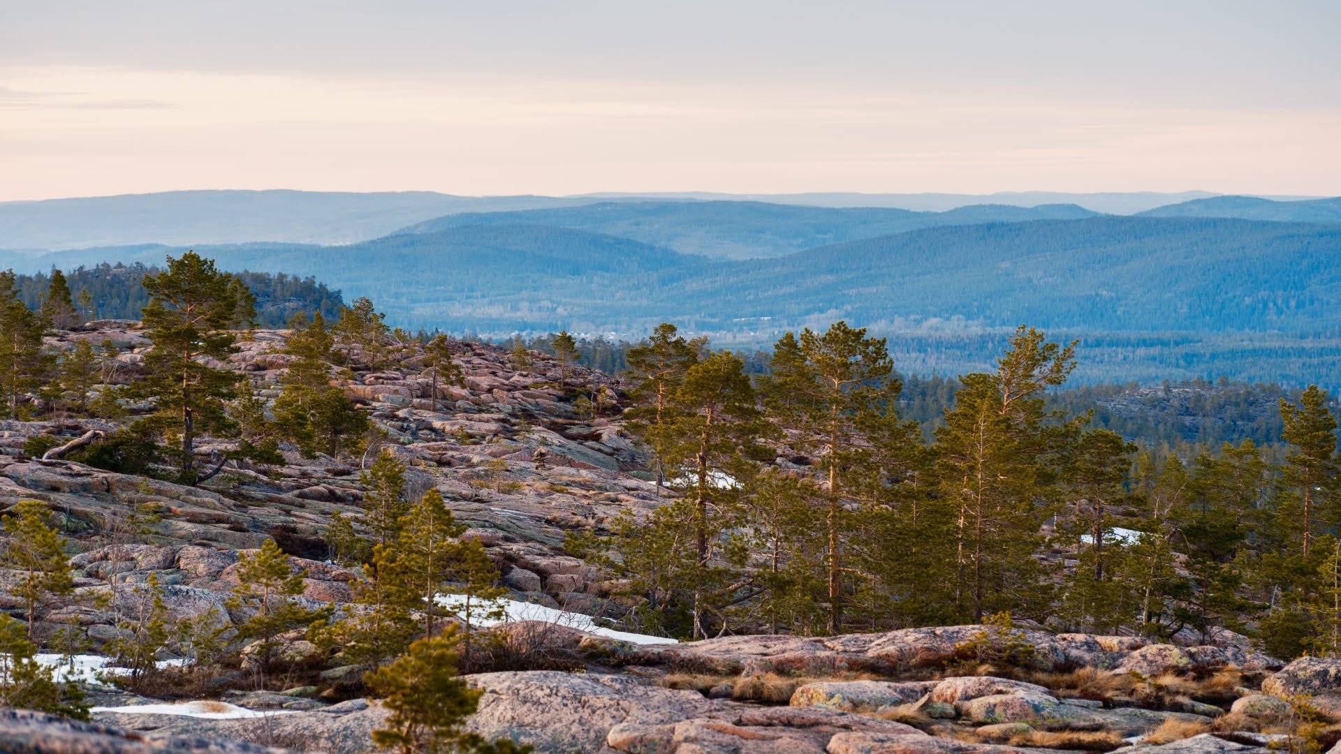
Ångermanland is the landscape where the sea has left behind mountains, crevices and polished cliffs. Here you can start the day in an old coastal forest, climb a mountain with a view of the Bothnian Sea and end by a river where people have left their mark for thousands of years.
This is the nineteenth article in our series “Attractions in every landscape” . After Medelpad we continue north to Ångermanland – a landscape that is primarily associated with the High Coast, but which extends far inland. Ångermanland’s highest point is Tåsjöberget, 635 meters above sea level . It is not a mountain peak in the classical sense, but the height reminds us that the landscape contains much more than the most photographed views of the coast.
Here are seven nature experiences for those who want to hike, discover and understand the landscape up close.
1. Skuleskogen National Park and Slåttdalsskrevan
Skuleskogen National Park is the obvious starting point for many who want to experience Ångermanland on foot. The national park is located on the High Coast and consists of forest, rocky areas, mountains and rift valleys formed by land uplift.
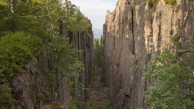
The most famous attraction is Slåttdalsskrevan , a long crack through the mountain with vertical rock walls. The path there is not technically difficult in the usual sense, but the terrain is hilly and rocky in places. The differences in altitude are felt more than the distance on the map suggests.
From the entrances to Skuleskogen, several trails lead towards the crevice and further up Slåttdalsberget. From there, you get a better understanding of how the coastal landscape is connected. The forest opens up, the sea is visible between the heights and the old rock formations become clear.
The national park has several rest areas, tent sites and open overnight cabins. This makes the area useful for both a short day trip and a longer hike. Always read up-to-date information about trails, parking and any temporary restrictions at Sweden's national parks .
Equipment: Sturdy shoes with good grip are more important than extremely light weight. Rocks, roots and wet areas require footwork. Bring reinforcement clothing even in summer. Coastal weather can change quickly.
2. Skuleberget and the view over the High Coast
Skuleberget rises approximately 295 meters above sea level and is one of the most accessible viewpoints on the High Coast. It is also a good place to feel the difference between taking a short excursion and actually hiking.
The summit can be reached via several trails. The climbs are steep and some sections require you to take it easy, especially if the mountain is wet. The reward is a mile-long view of forests, bays and coastal islands.
You can also take the cable car up during parts of the year. It's a practical option if you're hiking with people of different physical abilities or want to save your legs for a longer hike later in the day. There's no prestige in walking every meter of elevation if the goal is to get a good overall experience.
Skuleberget works well as a day trip on its own, but can also be combined with stages on the Höga Kusten Trail. The question is what do you want to get out of the day: a viewpoint with a reasonable amount of time or a longer hike where the summit is only part of the route?
Tåsjöberget, Ångermanland's highest point at 635 meters, is located far from the most visited parts of the High Coast. The difference between the peaks says something significant about the landscape: Ångermanland is not just about height, but about how sea, mountains and river valleys meet.
3. The High Coast Trail – Ångermanland's great hiking classic
The High Coast Trail is Ångermanland's signature trail. It is approximately 130 kilometers long and runs from the High Coast Bridge at Hornöberget to Örnsköldsvik. The trail is divided into stages and can therefore be used in several ways.
You don't have to walk the entire trail. Choose two or three sections for a long weekend, or plan for about five to seven days if you want to hike most of the route. The trail passes through coastal forest, hills, nature reserves and Skuleskogen National Park.
The terrain is not alpine, but it is more demanding than many first-time hikers expect. Repeated climbs and descents put a strain on the legs. A stage that looks moderate on the map can feel long when the backpack is full of food and water.
Therefore, plan according to daylight, weather and the group's actual pace. Use the High Coast Trail's current information for stage descriptions, service and practical planning.
Equipment for several days: A well-fitting hiking backpack makes a bigger difference than small weight savings on individual items. A stable tent , a sufficiently warm sleeping system and a sleeping pad that insulates against the ground are the foundation. A lightweight sleeping bag is only a good choice if it also gives you a margin when the night gets colder than the forecast.
For technical details on down, CUIN and how fill weight affects warmth, see our guide to down in sleeping bags . A cold night will ruin your recovery faster than a few extra pounds in your pack.
4. Nordingrå, Bönhamn and the World Heritage Trail
Nordingrå is the geographical and experiential core of the High Coast. Here the landscape becomes more broken up. Red granite cliffs, bays, forested hills and small coastal villages are located close to each other.
Bönhamn is a good destination for those who want to combine hiking with coastal surroundings and cultural history. The old fishing village is close to several trails and coastal stretches where you can build a day trip according to your own ability.
The World Heritage Trail also runs through the area, a roughly ten-kilometer-long trail divided into stages. It provides a different perspective than the High Coast Trail. Here, the focus is more on Nordingrå's continuous coastal and cultural landscape than on a single long hike from point A to point B.
It is an area where maps and planning pay off. Some tours may look short but contain many small elevation changes. Other routes are easier but take time due to detours, swimming stops and viewpoints.
Bring water, extra layers and a simple raincoat even if the forecast looks stable. The open coastal locations make the weather more noticeable. Balance is more important than chasing the lightest pack.
5. The polished cliffs of Rotside by the sea
The Rotsidan is a roughly four-kilometer stretch of coastline with flat outcrops that have been polished by the sea. The cliffs are made of dark diabase and lie low to the water. Here you will have a completely different hiking experience than on the steep paths of Skuleberget.
The marked path along the beach is relatively easy to walk, but the rocks can become slippery in rain and high seas. In strong winds, the terrain changes quickly. The same flat rocks that are calm and pleasant on a sunny day can become exposed when the waves come in from the sea.
The root side is therefore suitable for both a shorter nature excursion and as part of a longer trip on the World Heritage Trail. There are rest areas and designated fireplaces. Do not light fires in other places, and respect the rules for camping in the reserve. A freestanding tent is practical because the ground on the rocks is not always anchored.
Read more about conditions, service and rules at the Västernorrland County Administrative Board .
.webp)
6. The Granvågsnips along the Ångermanälven
Ångermanland is not just a coastal landscape. Along the Ångerman River there is a nip landscape with steep erosion slopes, ridges and views over the river. Granvågsnipora is one of the places where the geology of the river valley becomes particularly clear.
The ravines have been shaped by the work of the river over a long period of time. This gives the hike a different character than the one you encounter on the High Coast. Here it is not the waves of the sea that have ground the rock, but running water and erosion that have carved their way into the landscape.
The area around Sollefteå and the Ångermanälven is suitable for shorter trips and combinations with local trails, including Nipleden. Check the current route on a local map before you set off. Nip terrain can involve steep slopes and narrow paths, even when the total distance is short.
It is also a good reminder of Ångermanland's breadth. Far to the northwest lies Tåsjöberget at 635 meters above sea level, while the river valley offers hiking where the shape of the landscape itself is the great attraction.
7. Nämforsen and the rock carvings at Näsåker
At Näsåker, nature and history meet at Nämforsen. The rapids, the river and the steep cliffs create a special environment, but it is the rock carvings that make the place unique.
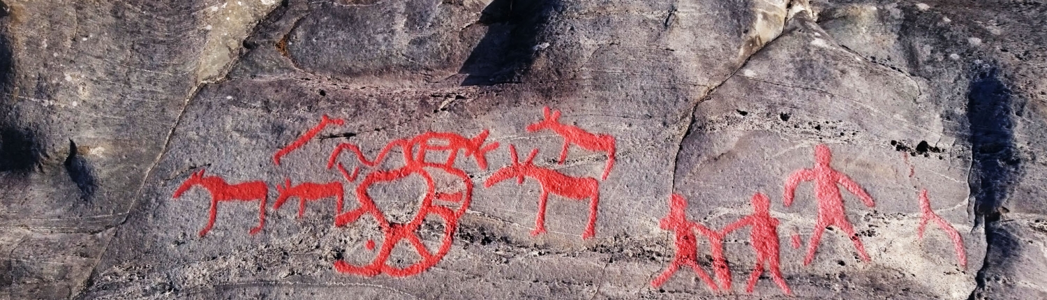
According to the Nämforsens Hällristningsmuseum, there are 2,595 preserved rock carvings here. The oldest are believed to be around 6,000 years old. The motifs include moose and other animals that link the site to people's lives along the river during the Stone Age.
The hike is shorter and more accessible than on the High Coast Trail. This makes Nämforsen a good stop for a day trip, a family outing or as the end of a longer trip through Ångermanland. Walk on designated walking paths and avoid stepping on the carvings themselves. The ancient remains are sensitive and cannot be replaced.
The place also shows why a nature experience doesn't always have to involve a long day with a heavy backpack. Sometimes a short walk, the right weather and time to actually look is enough.
How to plan a hiking trip in Ångermanland
Ångermanland can be experienced on several levels. For a weekend you can combine Skuleberget with a shorter trip in Skuleskogen National Park. For a longer trip you can spend several days on the Höga Kusten trail and then continue towards Nordingrå, Rotsidan and Bönhamn.
If you want to see more of the inland, you can add Granvågsniporna and Nämforsen. Tåsjöberget, the highest point in the province at 635 meters, requires separate planning and local knowledge. It is not a peak you just add as a quick detour from the coast.
Pack for the trip you're actually going to do. Coastal trails require grip and rain cover. Multi-day trails require a well-thought-out backpack , a reliable sleeping system, and cooking that works in wind. A light sleeping bag is good when it suits the temperature, but sleep and safety are not areas where you should blindly cut weight.
Ångermanland rewards those who plan ahead. The weather changes, your legs get tired and the distances between the sights are greater than they first appear on the map. The best equipment is therefore not the most extreme. It is the one that works when the wind increases, the rain comes and the day becomes longer than planned.