
 Svenska
 Dansk
Dansk
 Suomi
Suomi
 Deutsch
 Polskie
 Français
 Nederlands
 Italiano
 Español
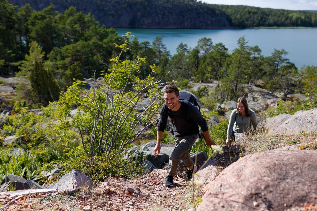
Åland is a self-governing and Swedish-speaking region in Finland. It is also an archipelago where hiking is often shaped by geography: many islands, ferry connections, rocky coastlines, forests and seaside paths.
The distances are short, but the nature changes quickly. One morning can contain deciduous forest and spring flowers. A few hours later you are walking over windswept rocks with the sea close on several sides. This makes Åland interesting for both short nature trails and longer tours with several stages.
Here are seven nature experiences to start with. Always check current information about trail conditions, markings, access and any reserve regulations before setting off.
1. The cave path at Getabergen – mountains, caves and sea views
The Cave Path in Geta is one of Åland's most distinctive hiking experiences for those who want hilly terrain. Geta municipality states approximately 5 kilometers , while Visit Åland states 4.7 kilometers. The start is at the Soltuna restaurant on Getabergen.
The path goes through wild rock formations, pine forests and rocky terrain. Along the way there are cave environments, historical traces and views of the sea. At Djupvik the terrain becomes particularly dramatic.
This is not a walk where you just follow a level path. The municipality describes the Cave Path as relatively demanding in parts and recommends that you allow about two to three hours. Wet rock surfaces can be very slippery. Wear shoes with stable soles and walk slowly on the steeper sections.
Trail information and status may change. Please read Geta Municipality's current information about hiking trails before you go.
2. Stornäset in Kastelholm – choose between forest and beach
Stornäset in Kastelholm is located in the municipality of Sund and offers several variations of a relatively easy nature experience. The official information states approximately 2.5–5 kilometers , depending on which path or loop you choose.
Here you will encounter forest, beaches and beech forest. The longer version follows more of the beach environment, while the shorter one goes through the forest. The combination makes Stornäset suitable when the group wants to experience nature without embarking on a full-day hike.
The shoreline also provides opportunities to experience birdlife. Keep your distance from birds and other animals, especially during the breeding season. Stay on marked paths and do not use shorelines or headlands as resting areas if there is a risk of disturbing birdlife.
The trails are listed as easy, but some sections can be more challenging. A pair of regular hiking boots is usually sufficient for a dry day. After rain, it is wise to prioritize grip over light weight.

3. Herröskatan – short coastal hike with open rocks
Herröskatan Nature Reserve is suitable when the goal is a shorter trip with a clear coastal character. The Åland Real Estate Agency's information indicates a hiking trail of approximately 1.6 kilometers . Approximately 800 meters are accessible for people with disabilities and strollers.
The environment consists of a rocky coast, open rock outcrops, coastal nature and sea views. There is also a lookout tower and historical remains from the world wars. The terrain is described as easy, but rock outcrops still require attention. An easy trail is not automatically risk-free when the surface is wet, covered in algae or covered in leaves.
Don't go to the far end of the cliffs just to get a better picture. The wind can pick up quickly at the coastline, and slippery rocks provide poor footing. A windbreaker and an extra warm layer take up little space but can make a big difference when you stop.
You can find an official trail map for Herröskatan at the Åland Real Estate Agency .
4. Ramsholmen – deciduous forest and spring flora near Mariehamn
Ramsholmen Nature Reserve is located near Mariehamn and is a good choice for a short, nature-oriented excursion. The marked nature trail is approximately 1.5 kilometers long , although length information may vary slightly depending on how the loop is measured.
What makes Ramsholmen particularly interesting is the deciduous forest, the deciduous meadows and the early spring flora. During the spring, the area can boast large populations of white primroses, blue primroses and primroses. Wild garlic and orchids also occur in the area.
It is important not to pick plants here. Orchids are protected and may not be picked, and the reserve's rules may be stricter than the general right of way. The path may also be wet during certain seasons.
Follow the marked trail, keep your dog on a leash and be considerate of grazing animals if there are any in the area. Ramsholmen is a place to walk slowly and observe, not to try to maximize your mileage.
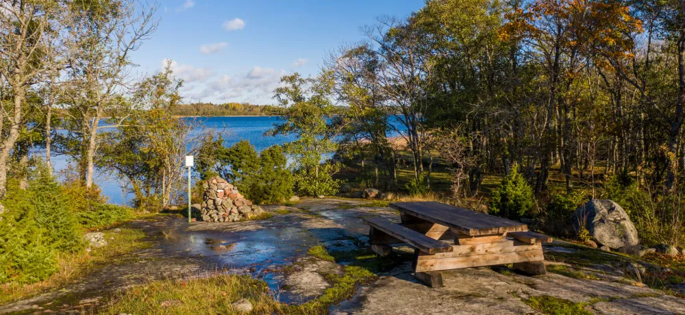
5. Trollstigen at Getabergen – the verified troll experience
The name needs to be clarified. The officially described trail in northern Åland is called Trollstigen , not Trollskogen. Trollskogen is primarily associated with Öland in Sweden. On Åland, however, there is the Trollstigen at Getabergen, starting near Soltuna.
The Trollstigen is about 1 kilometer long and is aimed especially at children between the ages of four and ten. Signs and stories about trolls and animals make it a nature experience for families, but it can also serve as a short introduction to the Åland mountain terrain.
Gaps, cliffs and uneven ground enhance the experience. However, take the usual safety rules seriously: children need supervision near steep slopes and slippery rocks. A short trail doesn't require much equipment, but good shoes are still more useful than thin casual shoes.
See Geta Municipality's description of Trollstigen together with the information about Grottstigen.
6. Sadelinleden and Höckböle Nature Reserve – for a longer trip
The Sadelin Trail runs through Hammarland, Finström and Geta. Visit Åland and Finström Municipality state a total distance of approximately 77 kilometers . It is a completely different type of hike than Ramsholmen or Herröskatan. Here you need to plan stages, water, food, transport and possible overnight stay.
In Geta, the trail begins or ends at Höckböle Nature Reserve. Geta Municipality also points out that the part in the municipality is not maintained by the municipality and can sometimes be difficult to navigate. This is crucial information. A long trail is not automatically a complete and problem-free long-distance route.
Höckböleholmen also has a shorter nature trail of approximately 1.8 kilometers through deciduous forest, deciduous meadow, beach and rocky terrain. It can be a more limited alternative, while the Sadelinleden requires more experience and more careful orientation.
Check the route, starting points, markings and current trail status before setting off. Use both Finström Municipality's information about the Sadelin Trail and Geta Municipality's updates .
For a multi-day trip, you need equipment according to the weather and terrain, not according to an idealized packing list. A functioning backpack , wind and rain protection, map or GPS, charging, first aid and a reliable sleeping system are more important than saving every gram. If you choose a sleeping bag or quilt, you can read our guide on bird down, CUIN and fill weight . A sleeping pad that is too thin can cause ground chill and poor recovery, even when the day's stage feels reasonable.
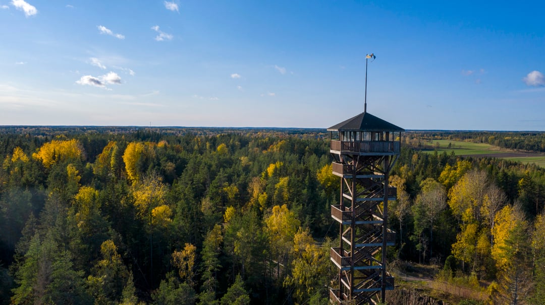
7. Orrdalsklint – Åland's highest point, but not an ordinary hiking trail
Orrdalsklint in Saltvik is the highest point in Åland, approximately 129 meters above sea level . This makes the place geographically interesting, but it should not be treated as an obvious hiking destination.
Information about the trail's status and access is conflicting. There are descriptions of trails and previous markings, but the location is on or near private land and lacks a clearly verified, officially marked trail to the summit in the current trail system. Therefore, we do not encourage you to go there on a whim.
Check access and landownership issues with local, up-to-date information before planning a visit. Always follow prohibition signs and do not cross private land. If you cannot confirm that the route is permitted, choose another officially described viewpoint, such as Långbergen, where the Åland Real Estate Agency's hiking material describes forests, mountains and views of the North Sea.
Plan for ocean, ferries and rapidly changing weather
Åland does not require advanced equipment on every nature trail. However, the equipment needs to be appropriate for the situation. Ask yourself:
- Is it a short trail near a road or a full-day trip far from services?
- Are you walking on a forest path, wetland or open rocky coast?
- Do you need a ferry or paddling to reach the starting point?
- What happens if the wind increases and the rain comes earlier than expected?
Check the current ferry departures with Ålandstrafiken . Timetables vary between lines and seasons. A missed ferry can turn a simple day trip into a logistical situation.
Bring water, a packed lunch and a charged phone. Save the map offline and bring a physical map as a backup. Mosquitoes can be a problem in forests and wetlands, especially during warmer parts of the year. On coastal stretches, it is the wind and the cooling that often become the practical challenge.
Åland's right of public access differs in part from the rules in Sweden and the rest of Finland. The basic rule is simple: do not disturb or destroy . Follow marked paths, avoid private plots and close gates after you. Dogs must be kept on a leash out of consideration for wild animals and grazing animals. According to Åland law, open fires may not be lit in nature without the landowner's permission.
Read Åland's official information about the right of way before the trip. The right equipment will help you when the weather changes, but consideration and planning are what make the hike sustainable.
This is the first step in HikingStore's series about hiking in the Finnish countryside. The series continues with one landscape at a time – from the cliffs and archipelago of Åland and on through Finland.