
 Svenska
 Dansk
Dansk
 Suomi
Suomi
 Deutsch
 Polskie
 Français
 Nederlands
 Italiano
 Español
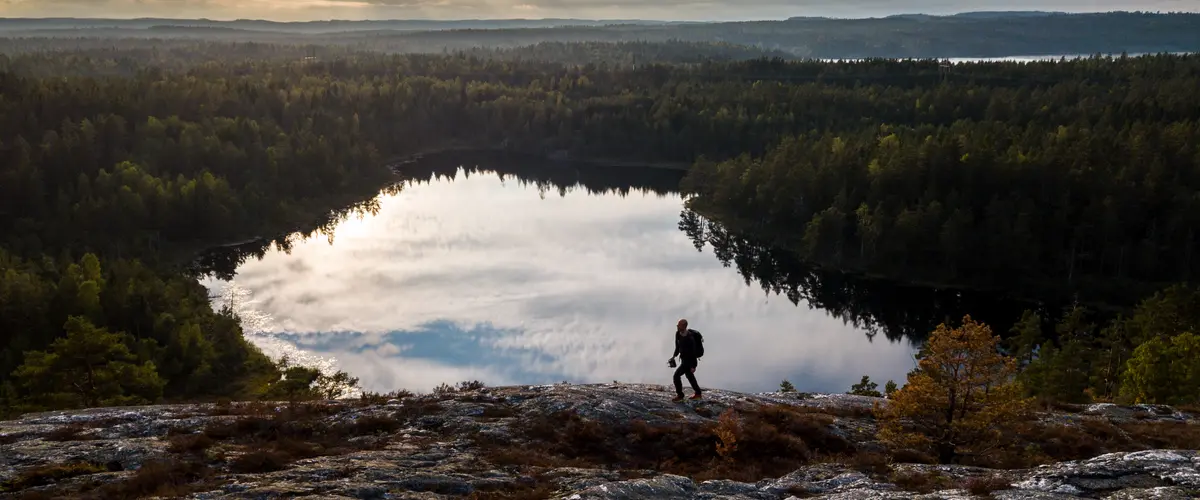
Dalsland is a landscape for those who want to get close to forest, water and silence. Here the distances between the lakes are short, but the experiences can stretch over several days. One day may include a simple walk to an aqueduct. The next may require a map, rain gear and planning for a hilly route without settlements.
This is the seventh article in the series “Attractions in every landscape” , after Skåne, Blekinge, Halland, Småland, Öland and Västergötland. The series follows a line from south to north. In Dalsland, the nature becomes more clearly wilderness-like, with large lake systems, forested mountains and many nature reserves.
So don't just ask yourself what you want to see. Also ask: How much time do you have, what kind of terrain awaits you, and what happens if the weather changes?
1. Dalsland Canal and the aqueduct in Håverud – the waterway through the landscape
Dalsland Canal is one of the region's most famous attractions, but it is best experienced when you see it as more than a technical facility. The canal connects lakes, forests and small communities in a navigable lake system that is approximately 253 kilometers long. Only about 12 kilometers is dug or blasted canal. The rest consists of natural lakes and water passages.
In Håverud , canal, road and railway meet in the same place. The freely hanging aqueduct guides boats over the rapids and is a clear example of how technology has been adapted to the terrain. Dalslands Kanal has up-to-date information about locks, boat trips and attractions along the waterway.
You don't need a boat to appreciate the area. Håverud serves as a starting point for walks, shorter hikes and excursions along the canal. If you want to stay longer, there are also trails in the area around Upperud and Dalsland Art Museum.
Pack for the conditions, not the postcard picture. Waterside environments can be windy and slippery, even in summer. Shoes with good grip, a windproof layer and enough water make a bigger difference than extra small gear.

2. Dalsland Nordmarken – lakes for paddling and tranquility
In northern Dalsland, the Dalsland Nordmarken lake system spreads out towards southern Värmland and the Norwegian border. Here there are long lakes, narrow bays and forests that are often located close to the water. The area is particularly suitable for canoeing and kayaking, but also for those who want to experience a landscape where the lakes control the route.
There are about a hundred organized campsites in the area. They are an important part of nature conservation because many visitors can gather in places that are suitable for overnight stays. On the DANO website you will find information about campsites, rules of procedure and the Nature Conservation Card.
Paddling requires different skills than hiking. You need to be able to judge wind, weather and distance across open water. A calm lake in the morning can become significantly more demanding in the afternoon. Life jackets are basic equipment, not an option. Also, plan for disembarkation and rest stops not always taking place where the map looks most inviting.
Choose organized campsites whenever possible and follow local fire and camping regulations. The balance is simple: use the freedom of the landscape without increasing the wear and tear on it.
3. Tresticklan National Park – unbroken forest on the Norwegian border
Tresticklan National Park is Dalsland's most distinctive wilderness experience. The park lies between Lake Stora Le and the Norwegian border and encompasses approximately 30 square kilometers of roadless and undeveloped forest.
The landscape consists of narrow mountain ridges, elongated lakes and open bogs. The pine forest is often sparse and barren, with lichen- and moss-covered outcrops. It gives a different feeling than the dense southern Swedish spruce forest. You can see further, but the road is not always easier.
The national park includes Bodalsvikenleden , Bråtaneslingan and Orshöjdsleden . The tour can be adapted to time and energy, but even a shorter route requires you to take responsibility for navigation and weather. Read current information from Sweden's national parks before setting off.
Bring a map even if the trail is marked. Charge your phone, but don't count on constant coverage. On longer trips, you need extra clothing, food, and a plan for how to get back if the pace is slower than expected.
4. Sörknatten – quartzite mountains and open views
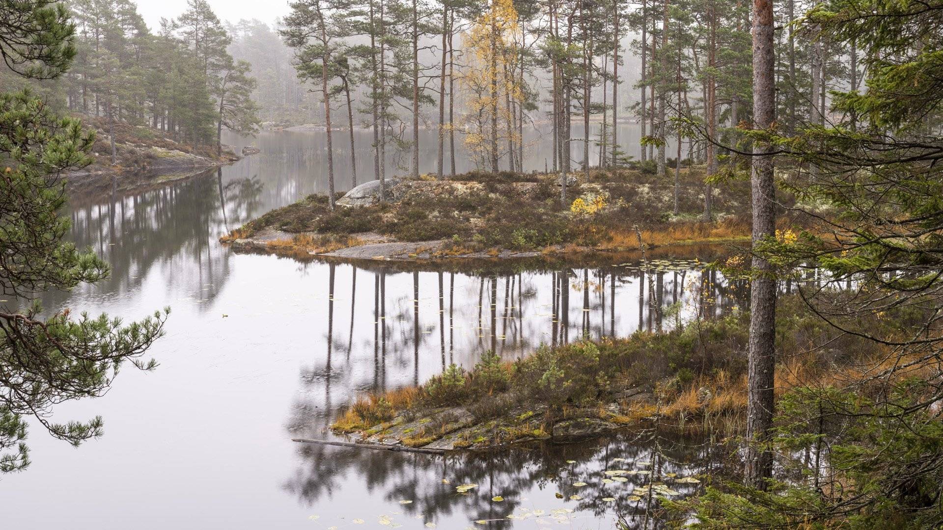
Sörknatten is located between the lakes Djup and Ånimmen. The nature reserve is characterized by elongated quartz ridges, barren outcrops and natural forest. The elevation differences are moderate in absolute terms, but the terrain feels clearly hilly as you move up and down between mountain ridges and valleys.
The Sörknattenleden trail is 6.5 kilometers and the Baståsenleden trail is 6 kilometers. The trails go through a landscape where the view often opens up suddenly over forest and water. Mosses and lichens grow on the outcrops, while the valleys have richer forests and lusher vegetation.
The County Administrative Board states that camping and fires are not permitted in the reserve. Always check current regulations for Sörknatten before planning an overnight stay.
Barren ledges become slippery when wet. Wear shoes with a stable sole and slow down on the downhill sections. This is often where fatigue and poor grip create problems. A clearly marked trail still requires judgment.
5. Högsbyn rock carvings – Bronze Age at Lake Råvarpen
Högsbyns petroglyphs are located by Lake Råvarpen in Tisselskog Nature Reserve. Here you will encounter both nature and cultural history. The agricultural landscape, the limestone bedrock and the proximity to the water explain why the place has been important for a long time.
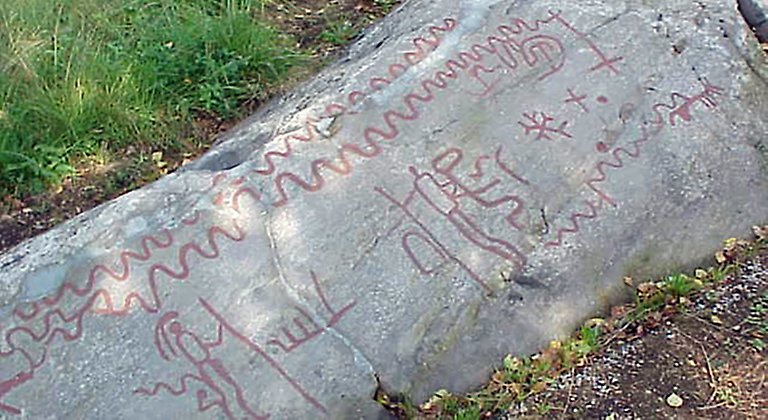
The slabs contain bowl pits, ships, circles and footprints. The area is considered Dalsland's largest rock carving area and has over 2,000 carved figures and signs spread across many slabs.
There is a path and a picnic area in the area, but the visit requires consideration. Do not walk on the carvings. The rock is worn by repeated steps, and what looks like a durable surface can be a sensitive ancient monument. The County Administrative Board's information about Tisselskog Högsbyn describes rules, parking and directions.
This is a good excursion for those who want to combine a shorter walk with a clear attraction. Bring rain cover even if the trip is short. Weather and surface always need to be taken into account.
6. Baljåsen – Dalsland's highest point
Baljåsen is Dalsland's highest point, reaching 302 meters above sea level. It is not a high mountain peak. The experience lies in the forest, the bedrock and the clear goal rather than in a dramatic peak silhouette.
The nature reserve east of Lake Edslan is very hilly. On the heights, mainly pine forest grows, while the valleys have richer spruce, mixed and deciduous forests. Marked paths lead to viewpoints on Baljåsen and Björndalsberget.
Follow the rules carefully. In the reserve, it is forbidden to camp, build shelters and make fires. The County Administrative Board's page on Baljåsen contains current information about trails, service and regulations.
Baljåsen is a good day trip, but bring water and warm clothing. The forest air and moderate altitude do not mean you are protected from wind, rain or cold.

7. Pilgrim's Trail – from Lake Vänern to the forests in the north
If you want to understand the variety of Dalsland in one trip, the Pilgrimsleden Dalsland is a good choice. The trail runs approximately 100 kilometers from Vänersborg to Edsleskog. The southern part runs through agricultural landscapes and along smaller roads. To the north, the terrain becomes more hilly and forested.
This makes the trail interesting even if you only walk one stage. You can choose a short day trip near Lake Vänern or plan several days through forests, lakes and hills. West Sweden's information about hiking in Dalsland includes stage information and links to maps.
On marked trails, you primarily need to be able to follow a map, read the terrain and adjust your pace. Off-trails require more: better orientation skills, greater margins and knowledge of public rights and reserve rules. Free hiking is not automatically better hiking. It can provide privacy, but also more decisions, more difficult navigation and a greater risk of disturbing sensitive nature.
Plan your equipment after the trip
For a short excursion, shoes with good grip, water, rain gear and a small backpack are often enough. For a longer trip, you need to build your equipment step by step:
- Weather protection: rain and wind clothing that works even when the temperature drops.
- Fluids and energy: especially important on trails where service is lacking.
- Navigation: map, charged phone and preferably an alternative route.
- Sleep: tent, sleeping bag or quilt and a sleeping pad that insulates against the cold ground.
- Safety margin: headlamp, first aid kit and extra heat for late or slow rides.
Light weight is good when it does not impair safety or recovery. A sleeping pad that is too thin can cause the ground to be cold and make sleep worse, even if the weather forecast looks mild. Please read HikingStore's guide to bird down in sleeping bags before choosing a sleeping bag or quilt. You can also find tents , sleeping bags , sleeping pads and backpacks at HikingStore.
Dalsland rewards a leisurely pace
Dalsland is not a landscape you need to rush through. Dalsland Canal shows how the waterways shape the villages. Dalsland Nordmarken provides space for paddling and overnight stays. Tresticklan and Sörknatten show the wilder side of the forests and mountains. Högsbyn connects nature and history, while Baljåsen gives the series its recurring goal: the highest point in the landscape.
Choose an experience based on weather, company and experience. Walk on marked trails when it reduces wear and tear or provides better margins. Choose a longer trip only when your equipment, navigation and stamina are sufficient.
The best equipment isn't the lightest on paper. It's the one that works when the rain starts falling, the slopes get slippery, and your legs are tired.