
 Svenska
 Dansk
Dansk
 Suomi
Suomi
 Deutsch
 Polskie
 Français
 Nederlands
 Italiano
 Español
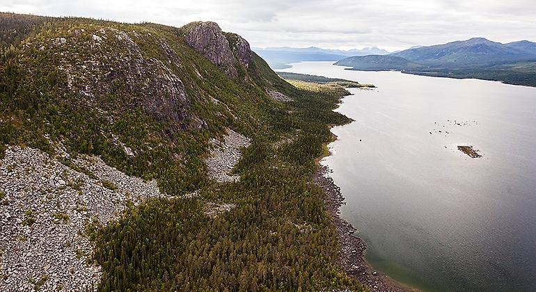
Lapland is often associated with Kebnekaise, Abisko, Sarek and long classic trails. Those places have their place, but this article is about something else: nature experiences where the very remoteness, silence and lack of ready-made facilities are part of the experience.
Lapland's highest point is Kebnekaise Nordtopp, 2,096.8 meters above sea level. It serves as a geographical reference in the landscape, but is not one of the goals here. Instead, we move between primeval forest, bogs, sandy plateaus, river canyons and mountain forests.
It is important to distinguish between the landscape of Lapland and the counties of Norrbotten and Västerbotten . Lapland is a historical landscape that extends across parts of both counties. Many of the places below are located in Norrbotten County, but it is the landscape – not the county border – that is the starting point for the series.
Several of the destinations are not your typical hiking destinations. They require more than just good shoes. You need to be able to navigate, plan for weather changes, and carry what you need.
1. Jielkká-Rijmagåbbå – primeval forest and the Easy Elsie plane wreck
Jielkká-Rijmagåbbå, also written Jelka-Rimakåbbå, is located west of Porjus in Jokkmokk municipality. It is a large, almost roadless primeval forest area with high natural and landscape values. The reserve is located on the watershed between the Stora and Lilla Luleälven rivers and connects to the Ultevis mountain forest in the west.
The most concrete excursion is to Easy Elsie , a British bomber that crash-landed on the Gejnutjiegge bog in 1944. A boardwalk leads to the wreck from road 819, north of Porjus. It is a clear excursion in an area where the rest of the terrain quickly becomes considerably more demanding.
Easy Elsie is not just a historical site. The road there also shows the difference between an organized tourist destination and a pathless reserve. When the footbridge ends, there is no obvious continuation. If you want to continue, you need to be able to read the terrain and have a plan for the return journey.
Check current information with the Norrbotten County Administrative Board . Follow the footbridge, leave the wreck untouched and take reindeer husbandry into account.
2. Pärlälven mountain forest – river, old growth forest and older cultural traces
The Pärlälven mountain forest is located approximately 43 kilometers west of Jokkmokk and covers approximately 1,158 square kilometers. It is one of Sweden's larger roadless primeval forest areas, with coniferous forest, mountain birch forest, bogs, low mountains, lakes and watercourses.
The Pärlälven is the natural backbone of the area. The river flows through the forest landscape and carries a long history of fishing, hunting, reindeer herding and settler life. Along the river valley there are older cultural traces and environments that tell of Sami use of the landscape and of settlers who lived here until the 20th century.
Here you can plan a longer trip with tents, fishing or paddling as part of the plan. However, it is not an area where you should expect to be able to hike every planned distance at your desired pace. Bogs, dense forests, water and rocky ground affect accessibility.
There are simpler huts and more fully equipped cabins in the area, but always check the current status before setting off. Fishing requires a fishing license, and parts of the area may be periodically affected by military activity.
Read the County Administrative Board's information about the Pärlälven mountain forest before planning your route and overnight stay.
3. Lina mountain forest – old growth forest north of Gällivare
North of Gällivare lies Lina mountain forest, a large continuous forest and wetland landscape with old growth forest, lakes, bogs and low mountains. The area is said to cover around 981 square kilometres and is also designated as a Natura 2000 area.
Lina mountain forest is interesting for those who want to experience the transition between forest land and mountains without seeking out an established tourist destination. Here, the natural value is not concentrated in a single viewpoint. It lies in the whole: old trees, open bogs, small bodies of water and long distances between roads and buildings.
This is an area for those who accept a low level of service. Don't plan based on there being a marked trail, a dry rest area or a secure mobile connection at the next elevation. A map and compass should be basic equipment, even if you use GPS.
During the summer, mosquitoes and wading through wet areas can set the pace. During the fall, the days get shorter and the nights quickly get cold. A trip in Lina mountain forest is therefore best when you choose a level of ambition that suits the group's experience and equipment.
4. Torneträsk-Soppero mountain forest – marshes, bogs and Arctic birdlife
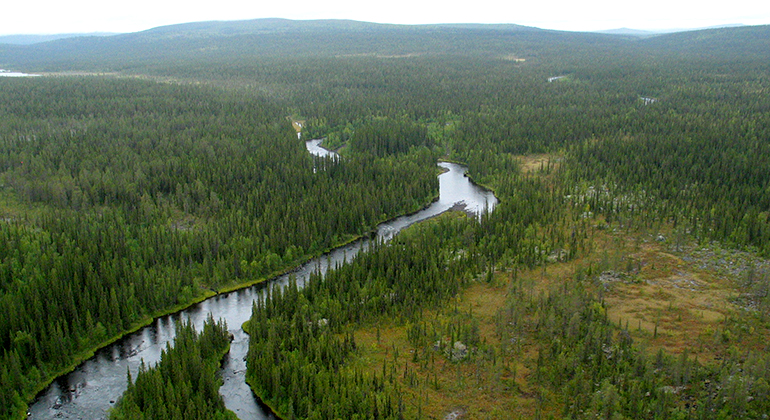
Torneträsk-Soppero mountain forest is Sweden's second largest nature reserve and stretches approximately 120 km from west to east. Despite its size, the area is sparsely visited. This is because the reserve largely lacks landscaped trails and tourist cabins.
The landscape includes old pine and spruce forests, mountain birch forests, low mountains and extensive bogs. In several places there are palsar – peat hills with permanent frost – and aapa bogs with long stretches of bog through wet sedge fields. For bird lovers, the area is particularly interesting. Common shrikes, little shrikes, common snipe and little snipe are among the species that can be found here.
There are also ancient remains in the form of trap pits, sacrificial sites, hut sites and house foundations. They should be considered part of the landscape, not as excursion destinations to go near or change.
The E45 passes through the eastern part, but large parts of the reserve are roadless. The entire area is also year-round land for reindeer herding. Read the County Administrative Board's reserve information and plan your trip with respect for both the wetlands and the reindeer herding facilities.
5. Särkitievat – sandy plateaus and a very old pine tree
Northwest of Muodoslompolo awaits Särkitievat, a different landscape with sandy plateaus and fire-damaged pine forest. Here the contrast with the mountains and bogs of Lapland is clear. The sandy soil gives the pines different growing conditions than the wetter forests around them.
A special attraction is a pine tree that is said to be 531 years old. Whether you are looking for the tree or just walking through the area, the point is to take a closer look at the forest. The sound of fire, rough bark, dead wood and slow growth tell more than a quick passage through the landscape.
Särkitievat is suitable for a nature-interested day trip or as part of a longer trip in Tornedalen. Do not expect an extensive trail system. Use a current map, check the route to the area and avoid driving outside permitted roads.
Old trees are fragile even when they look sturdy. Don't climb them, don't break branches, and leave dead wood where it is. That's how the place retains its value even after your visit.
6. Njietjagårsså – canyons above Stora Luleälv
Njietjagårsså is located on the north side of the Stora Luleälven River in Jokkmokk Municipality. The reserve protects old natural forest and two distinct canyon-like valleys: Njietjagårsså and Lijggegårsså.
The landscape offers views of the river, but that is also where the risks lie. The slopes can be steep, rocky and difficult to navigate. A map may show a short distance, but it does not always tell you how long it will take to get through boulder fields, dense forest or steep passages.
This is not the place to improvise a shortcut to a viewpoint. Stay away from steep slopes and riverbanks. Turn around when the ground becomes unstable. If you are walking alone, someone at home should know your route and when you plan to be back.
Njietjagårsså clearly shows why equipment is a safety issue. Stable footwear, rain and reinforcement clothing, first aid and a functioning navigation system weigh less than the consequences of an injury far from the road.
7. Laxforsberget – old pine trees and views over the Kalix river valley
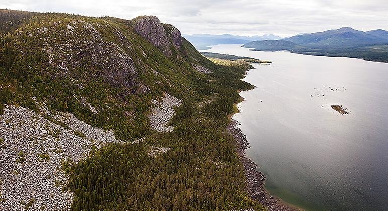
Laxforsberget is located about 30 kilometers northwest of Överkalix. The reserve is smaller than several of the other destinations in the article, but the experience is concentrated: primeval pine forest, deciduous trees, rocky and boulder fields, and views of the Kalix river valley.
A hiking trail starts in Jokkfall and winds its way up to the top. The path is narrow and partly steep and rocky. There is an older rest hut on the mountain, but check its condition and availability before you expect to use it.
The forest has old pine trees and plenty of dead wood from previous fires. Here you can also see species such as lungwort and rosewood. The rare fin rose is found in the area and is protected. It should not be picked or damaged.
Read current information about Laxforsberget at the County Administrative Board . On a rainy day, the path can be significantly more demanding than the difference in altitude first suggests.
How to plan a trip to Lapland's more secluded nature
Start with the big decisions. Should you hike or camp? How far is the nearest road? Is there a marked trail, or will you have to find your own way? What temperature and precipitation can you expect?

For a multi-day trip, the tent, backpack and sleeping system are the most important parts. A sleeping pad that is too thin can cause the ground to be cold and poor recovery. A light sleeping bag is not a good choice if the temperature margin disappears when the weather changes. Please read our guide to bird down in sleeping bags when comparing CUIN, fill weight and different down types.
At HikingStore you will find tents , backpacks and sleeping pads for different types of trips. Choose by area of use, not by the lowest weight on paper.
Always bring a physical map and compass. GPS is a good aid, but the battery will run out and electronics can be damaged. Have waterproof packed reinforcements, extra food and the ability to stay warm in case you are delayed.
Mosquitoes and gnats can be a nuisance from early summer onwards. Long, thin garments, head nets and mosquito repellent make a bigger difference than many small gadgets. Autumn often brings calmer insect conditions, but requires more warmth and better planning of daylight.
Finally: read the reserve regulations before leaving. Camping, fires, dogs, fishing and off-road driving may be regulated differently. The right of public access applies, but it is based on not disturbing or destroying. In Lapland, this also means showing consideration for reindeer herding, reindeer fencing, reindeer herder's cabins and sensitive cultural trails.
The best nature experiences are not always the most accessible. But roadless country only rewards those who plan for reality: fatigue, cold, wet bogs and weather that changes faster than the forecast. The balance lies in carrying sufficient margins without making the pack unnecessarily heavy.