
 Svenska
 Dansk
Dansk
 Suomi
Suomi
 Deutsch
 Polskie
 Français
 Nederlands
 Italiano
 Español

The Kymmene Valley, or Kymenlaakso in Finnish, is the landscape where the Kymmene River meets forests, lakes and the coast of the Gulf of Finland. Here there are both easily accessible nature trails and terrain that requires better balance, a map and getting used to rocks.
This is the fourth article in HikingStore's series about the landscapes of Finland, after Åland ,Uusimaa and Southwest Finland .
The selection below is not a list of the most photographed places. The focus is on how nature is actually experienced on foot, what equipment is needed and what you should check before setting off.
1. Kammarmäki and Saaramaa Nature Reserve – forest, rocks and small lakes
Kammarmäki's outdoor trail is close to the border between Kouvola and Fredrikshamn. The approximately 4.6-kilometer round goes partly through the Saaramaa nature reserve and passes forest, boulder fields and lakes Vuorilampi and Sammakkolampi.
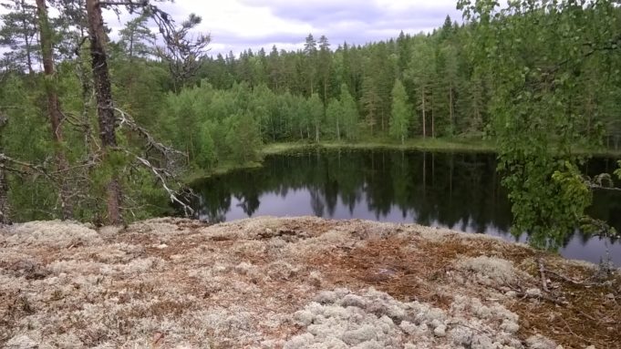
This is not a completely smooth nature trail. The surface is rocky in places and some steeper sections have ropes. Wet roots, moss and rocks become slippery after rain. Expect a demanding short hike rather than a walk for thin summer shoes.
The target group is hikers who want a concentrated forest experience without planning a whole day. Children with terrain experience may enjoy the trail, but small children and dogs require extra supervision on steep slopes.
Car is the easiest way to get around. The final road can be narrow and gravelly. Check the municipality's current information on trail status, road conditions and service before setting off. Kammarmäki is best from late spring to autumn, but snow and ice significantly change the difficulty level.
2. Väliväylä – follow the water, but don't call it a hiking trail
Väliväylä is a 113 kilometer waterway from Kivijärvi in South Karelia via the Kymmene valley towards Kouvola and the Kymmene river. It is primarily a paddling and fishing route, not a continuous marked hiking trail.
It still makes the area interesting for hikers. At Kyykoski, Sulunkoski and Taikinakoski, for example, there are rest areas, bridges and shorter paths along the water. Between Kyykoski and Taikinakoski there is an unmarked route, according to Kouvola city's current description of Väliväylä .
Here you will find rapids, calm bodies of water and coniferous forest. The surface varies between road, path, beach and uneven forest ground. It is best suited for those who want to combine a shorter walk with a break by the water, not for those looking for a clearly signposted long hike.
Kyykoski can be reached on foot from the Sulunkoski parking lot. According to the municipality, the trail first goes to a small bridge and then to the Kyykoski rest area. The road is not winter-maintained, so check the conditions before driving there.
At the rest areas there may be a fireplace, shelter, toilet and firewood, but the service varies between the places. Burning requires that there is no fire ban. Fishing is regulated and certain waters require special permits.
3. Valkmusa National Park – spanning a living bog landscape
Valkmusa National Park in Pyttis shows a different side of Kymenlaakso. Here, the hike is not guided by elevation differences, but by water, springs and sensitive bogs.
The national park has two marked trails. The western footbridge loop at Simonsaari goes over bog and leads to a birdwatching tower. The surface is easy to follow, but the footbridges can become slippery from rain, frost and snow. They are not maintained in winter.
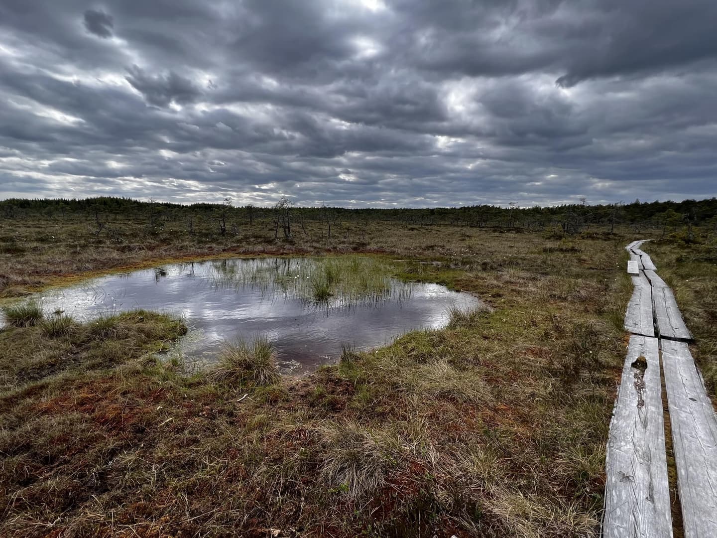
Valkmusa is suitable for families and hikers who want to see birds, open bogs and small ponds without a long or technically difficult day hike. Bring binoculars, a packed lunch and shoes with good grip. Mosquitoes can be a problem during warm periods, especially near water and low vegetation.
Always follow the signs and marked trails. The bog is sensitive and spring birdlife may be temporarily restricted. The current page on Luontoon.fi also states rules for fires, camping, dogs and waste. There are no garbage cans, so unpack everything.
Spring is great for bird watching. Autumn brings colors and cranberries. In winter, the area can be suitable for skiing or snowshoeing, but then you have to judge the ice, snow depth and load-bearing capacity yourself.
4. Ulko-Tammio – hiking on an island where logistics is half the tour
Ulko-Tammio in the Eastern Gulf of Finland National Park provides a coastal experience that differs from the mainland forests. The official Ulko-Tammio nature trail is 2.8 kilometers long and takes about one to two hours.
The trail goes over bare cliffs and through forest. It tells both about the island's nature and its military history. Along the way there are restored cannons from World War II. The cliffs are beautiful but become slippery when wet. Therefore, shoes with stiff soles and good friction are more important than low weight.
You will need to plan boat transport. The island is accessible by private boat or kayak, and in summer there may be bookable or scheduled boat trips. Always check current traffic separately. Coastal weather can stop the return boat, and a calm forecast at departure is not a guarantee of calm seas later in the day.
There are dry toilets, a campfire site and camping at designated sites, but no water points and no garbage cans along the trail. Bring your own water, lunch and garbage bag. Follow the national park's rules regarding landing, bird protection and military restrictions. Not all islands are accessible at all times of the year.
5. Langinkoski Nature Reserve – riverine forest near Kotka
Langinkoski is an easily accessible destination on the Kymmene River in Kotka. The nature reserve combines rushing water, deciduous riverside forest and shorter walking paths around the historic fishing village area.
This is a good choice when the group has different abilities or when you want to do a short nature walk without leaving the urban region. The paths are mainly easy, but the coastal cliffs can be very slippery. Stay away from steep edges and rapids.
The nature reserve's rules state that visitors should use established trails to reduce wear and tear. Camping and fires are prohibited in the reserve. Dogs are not allowed to run loose.
Langinkoski is also a regulated fishing area. Fly fishing requires a permit, the number of anglers is limited, and special rules apply to salmon and sea trout. Check the fishing restrictions before combining hiking with fishing.
6. Kirkkojärvi and Lupinlahti in Fredrikshamn - lighter coastal nature
Hamina has several smaller nature destinations that are suitable for half a day. The Kirkkojärvi Nature Trail starts near the city center and provides an accessible introduction to forest, water and birdlife.
Also nearby is Lupinlahti, a bird-rich bay with a birdwatching tower. It is primarily a birdwatching destination, not a long wilderness trail. Therefore, the place is particularly suitable for families, photographers and hikers who want to take a shorter trip with a clear goal.
The terrain is generally easier than in Kammarmäki and Repovesi, but paths near water can be soft and slippery. Bring binoculars, a rain jacket and mosquito repellent during the summer. Ticks are common in southern Finland; check your skin and clothing after the hike.
Check the municipality's current information about maps, possible roadblocks and bird protection before you go. Bird life is most active during spring and early summer, but this is also when the sensitivity to disturbance is greatest.
7. Repovesi – choose a smaller loop and respect the terrain
Repovesi National Park is located in the Kymmene Valley and is the region's most famous hiking area. Ketunlenkki and the suspension bridge at Lapinsalmi can be mentioned as references, but the park is larger than most pictures show.
For a shorter and more concrete tour, you can choose the Korpinkierros , about 4.5 kilometers around Olhavanlampi. For a longer tour, the Koppelon kierros is an option around Tervajärvi, about eight kilometers.
Both trails are on hilly and rocky terrain with roots, rocks and elevation changes. They are suitable for hikers with normal fitness and stable shoes, but not for those who want to walk fast on even ground. Use poles if your knees or balance need relief.
Repovesi requires more planning than the length of the trail first suggests. Check water, rest areas, campfire sites and current trail information on Luontoon.fi . Have a map and GPS offline. Mobile coverage is not a planning strategy.
Equipment for the varied terrain of Kymenlaakso
Start with what affects safety and recovery:
- Shoes with grip. Boots or trail shoes with soles for wet rock and roots are more important than a few saved grams.
- Rain and wind protection. Lakes and the coast can change the weather quickly.
- Map and offline GPS. Especially important on unmarked routes on Väliväylä and on boat trips.
- Water and packed lunch. Do not assume that natural destinations have water points.
- Insect and tick protection. Mosquito repellent, covering clothing and a check after the trip are simple precautions.
- Poles. They provide extra support on the slippery cliffs of Kammarmäki, Repovesis and the coast.
For overnight stays, the same principle applies as on longer mountain trips: choose a sleeping system based on the actual temperature, wind and ground – not just on weight. A thin sleeping pad can cause ground chill and poor recovery even when the sleeping bag is warm enough. See HikingStore's tents , backpacks , sleeping pads and sleeping bags as a starting point. For the CUIN value of the down, fill weight and the difference between different types of down, read our guide to bird down in sleeping bags .