
 Svenska
 Dansk
Dansk
 Suomi
Suomi
 Deutsch
 Polskie
 Français
 Nederlands
 Italiano
 Español

Central Ostrobothnia, or Keski-Pohjanmaa in Finnish, is a flat landscape where the coast, river valleys, coniferous forests and large bogs meet. There are no long mountain passes here. The challenge lies instead in the distances, the soft ground and the weather that quickly changes between sun, wind and rain.
The clear main destination of the landscape is Salamajärvi National Park . But the Kokkola area, Lestijärvi, Perho and the coast around Öja also offer trails of different character. Some are suitable for an afternoon. Others require a map, packed lunch and the habit of planning a multi-day trip.
Here are seven nature experiences to start from.
1. Salamajärvi National Park – bog, primeval forest and reindeer
Salamajärvi is the most complete wilderness experience in Central Ostrobothnia. The landscape consists of barren pine forests, older spruce forests, lakes and open bogs. The area is also associated with the forest reindeer , the Finnish forest reindeer that gave the Peuran polku its name.
For a day trip, the Pahapuron lenkki is a good choice. Metsähallitus' current trail information gives the round trip as approximately 6 kilometers , although older information sometimes gives 7 kilometers. If you want to go further, there is the Vaatimen kierros , which in the current information is given as approximately 17.4 kilometers . The terrain is rocky and the round trip requires more time than the length first suggests.
There are approximately 60 kilometres of marked trails in the national park. Salamanperä Nature Reserve borders the national park and has special rules: you can only move around on marked trails there. In the Heikinjärvenneva restricted area, trail requirements also apply during the bird breeding season from 1 March to 15 July.
- Nature and surface: Bog, fens, rocky woodland and forest roads.
- Level: Pahapuro is suitable for experienced beginners. The duration requires good fitness and sturdy shoes.
- Season: Late spring to fall. Check snow and ice conditions before winter trips.
- Logistics: Koirasalmi is a central starting point. Check current road conditions, trail markings and services before setting off.
- Bring: Offline map, water, packed lunch and mosquito repellent.
See Metsähallitu's information about hiking in Salamajärvi National Park .
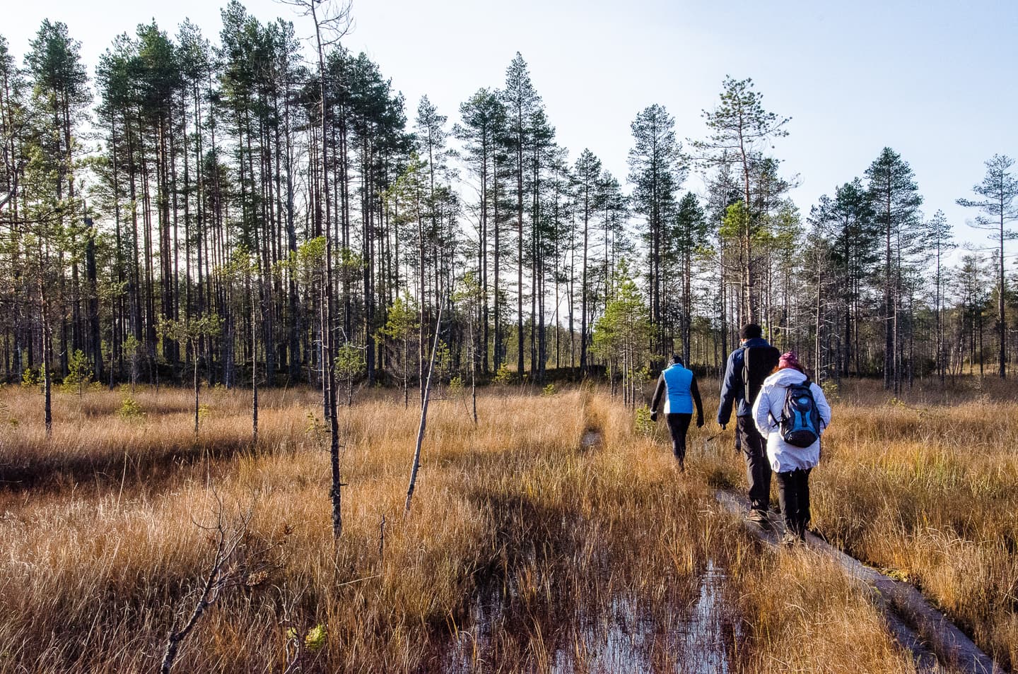
2. Peuran polku – choose a stage instead of the entire network
Peuran polku , Reindeer Path, is a trail network of approximately 115 kilometers. It runs through Central and Northern Ostrobothnia and Central Finland. The entire network should therefore not be described as a single trail within Central Ostrobothnia.
A specific stage in the landscape is the approximately 11-kilometer-long Peuran polku stretch in Perho , which is described in Luontoon.fi. Here you get the typical Suomenselkä nature: forest, bog, small lakes and long stretches without settlements.
For a longer trip, you can use parts of the main trail from the Lestijärvi area. The official main trail is now listed as approximately 78 kilometers in Luontoon.fi, while local presentations often round it to 77 kilometers. The important thing is not which number you choose, but that you plan the stage according to the map.
- Nature and surface: Sparse forest, bog, meadows, paths and forest roads.
- Level: Moderate to demanding. Orientation skills are needed on longer distances.
- Season: Snow-free period. In winter, markings may be hidden by snow.
- Logistics: The trail is not automatically a round trip. Plan transportation between start and finish or choose a circular route.
- Bring: Paper map as a backup, loaded offline map, food and enough water.
See Visit Lestijärvi's information on Peuran polku and Metsähallitus' trail information .
3. Öja archipelago trail – forest and coastal wind near Kokkola
The Öja archipelago trail west of Kokkola is approximately 21 kilometers long, according to both the city of Kokkola and Luontoon.fi. The trail offers a different view of the landscape than Salamajärvi. Here you walk through coastal forest, over ridges and near bays where the wind can be significantly stronger than inside the forest.
The terrain varies. Some sections are easy to walk, while others can become slippery after rain. The coastal humidity, wind and low cliffs require more attention than the elevation difference.
- Nature and surface: Coastal forest, wetlands, banks, paths and cliffs.
- Level: Moderate. The length and varying surface are noticeable in the legs.
- Season: Spring to fall. Late summer and early fall often provide more comfortable temperatures.
- Logistics: It is important to check the current trail status and where you will leave your car. Do not plan on using public transport or boat connections without checking the current timetables.
- Bring: Windproof layers, packed lunch and shoes with good grip. Wet rocks are slippery.
Kokkola City's official website about the Öja archipelago trail .
4. St. Olav Ostrobothnia – a pilgrimage trail with mixed terrain
St. Olav Ostrobothnia is not a pure nature trail. It is a pilgrimage trail that starts in Kokkola and continues through several Ostrobothnian landscapes southward. The northern part towards Vaasa is divided into day stages.
The first stage starts at Kaarlela Church in Kokkola and continues towards Luoto. It provides a good introduction to the trail in Central Ostrobothnia, but you should expect a mix of forest paths, gravel roads, cycle paths, asphalt and built-up areas.
- Nature and surface: Cultural landscape, forest, gravel and asphalt.
- Level: Physically often easier than a wilderness trail, but long and logistically more complex.
- Season: Spring to fall. Check for possible diversions.
- Logistics: Plan each day's stages separately. Start and finish are not necessarily close to each other.
- Bring: Comfortable shoes for hard surfaces, water and a charged phone.
St Olav Ostrobothnia's official website has up-to-date information about stages and the continuation of the trail through several landscapes.
5. Vattaja and Ohtakari – sand, coastal forest and open sea
The coastal areas of Vattaja and Ohtakari are located in Kokkola municipality. These include Karipolku , approximately 7.3 kilometers in one direction, and Ohtakari Nature Trail , approximately 1.5 kilometers. Together, they provide the opportunity to combine a longer coastal walk with a shorter nature trail.
Sand is treacherous in a quiet way. It provides little drama but costs energy, especially with a heavy backpack. On open stretches of beach, the wind can also cool the body quickly.
- Nature and surface: Sand dunes, coastal forest, beach and rocks.
- Level: Moderate for longer distances. Ohtakari is better suited for a short excursion.
- Season: Late spring to early autumn. Be careful after heavy rain and in strong winds.
- Logistics: Check current restrictions, access rules and trail status. Coastal areas may have special usage rules.
- Bring: Water, sunscreen, windproof clothing and shoes that grip the sand.
Kokkola city information about Vattaja and Ohtakari .
6. Valkeinen in Lestijärvi – easier lake round with the possibility to continue
There is a 5.5-kilometer round trip at Lake Valkeinen that, according to Visit Lestijärvi, is suitable for an easier nature excursion. Here you will get lake views, forests and the opportunity to stop at the Pökkelöniemi rest area.
Valkeinen also serves as a practical starting point for longer hikes on the Peuran polku, making the area suitable for groups with different levels of experience. Some can walk around the lake while others continue further.
- Nature and surface: Forest path, lake shores and shorter footbridge sections.
- Level: Easy to medium.
- Season: Summer and autumn. Check wet areas during spring and after rain.
- Logistics: Use current municipal information for route and starting point.
- Bring: Lunch bag, water and mosquito repellent. Don't make a short trail unnecessarily complicated.
Visit Lestijärvi's information about Valkeinen and other natural destinations .
7. Pakosuon kierros in Perho – shorter marsh tour for half a day
For a smaller and more concrete nature experience, the Pakosuon kierros trail in Perho is an alternative. Luontoon.fi lists the trail as approximately 4.4 kilometers long . It is suitable when you want to experience bogs and forests without planning a whole day on a long hike.
Short does not automatically mean dry or easy. Marshes can be demanding after rain and the paths can become slippery. The pace should be leisurely, especially if you are walking with children or in a group.
- Nature and surface: Bog, forest path and banks.
- Level: Easy to medium depending on weather.
- Season: Summer to autumn.
- Logistics: Check that the starting point and trail are open and accessible.
- Bring: Boots or shoes with good grip, mosquito repellent and extra socks.
See Pakosuon kierros on Luontoon.fi .
Pack for the terrain, not for an ideal image
Central Ostrobothnia rarely requires alpine equipment. However, it does require equipment that works when the ground is wet, the wind picks up, and the hike takes longer than planned.
Prioritize in this order:
- Shoes and clothing: Protect your feet from wet bog, sand and slippery roots. Dress in layers.
- Navigation: Download offline maps and bring a physical map on longer trips.
- Water and food: Don't expect all lakes and rest areas to have drinkable water. Check water sources before starting.
- Shelter and sleep: For overnight stays, choose a tent that can withstand wind and a sleeping pad that insulates against the cold ground. A sleeping pad that is too thin will result in poor recovery even during an otherwise successful trip.
For longer trips, you can compare HikingStore's tents , backpacks , sleeping pads and sleeping bags . When choosing a sleeping bag or quilt, fill weight, temperature limit and down quality are more important than just packing volume. Please read our guide on bird down in sleeping bags .
Ticks and mosquitoes are practical realities during the warmer season. Check your body after the trip and use long pants or mosquito repellent where necessary. Keep dogs on a leash when natural values, bird life or local regulations require it. Only burn in designated areas and never when a fire ban applies. Camp where public right of way and local regulations allow it.
Always check current trail status, any restrictions and fire warnings before setting off. The best equipment is not the lightest on paper. It's the one that works reliably when the trails are slippery, the wind is blowing and your legs are starting to get tired.
The next region in the series is Northern Ostrobothnia.