
 Svenska
 Dansk
Dansk
 Suomi
Suomi
 Deutsch
 Polskie
 Français
 Nederlands
 Italiano
 Español
 Norsk
Norsk

Satakunta is located on the west coast of Finland, between Southwest Finland and Ostrobothnia. The landscape is flat, but not monotonous. Here the Bothnian Sea meets sand dunes, coastal meadows, archipelago islands, bird-rich wetlands and forests around lakes and river valleys.
This makes Satakunta interesting for hiking, but also easy to underestimate. A beach promenade on hard sand is not the same as a trail over dunes. A footbridge over wetlands can be easy in dry weather and slippery after rain. On an archipelago island, the boat trip itself is part of the planning.
Here are seven verifiable natural destinations, arranged roughly from Rauma in the south towards Pori and Noormarkku in the north.
1. Omenapuumaa – coastal forest and cliffs in the Rauma archipelago
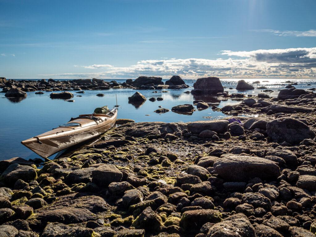
Omenapuumaa is a nature trail in the Rauma archipelago, approximately 5.3 kilometres long. The official route information is published via the Visit Rauma hiking portal and Outdooractive. The environment consists of coastal forest, exposed mountains and views of bays and the archipelago.
This is a good choice for those who want to experience coastal nature without planning a boat trip. The terrain is relatively easy, but roots, rocks and uneven cliffs require stable shoes. The hike is suitable for beginners with normal fitness and families with older children, but it is not a smooth walking path.
Check the current route, starting point and parking in the official route description before setting off. Coastal paths can be changed by storms and earthworks. Late spring, summer and early autumn are suitable seasons. After rain, the rocks quickly become slippery.
2. Sammallahdenmäki – a short walk through a World Heritage Site
Sammallahdenmäki is located inland from Rauma and is primarily a cultural environment, not a long hiking trail. The approximately 1.5 kilometer long marked path passes through a Bronze Age burial field with about thirty burial mounds and other stone formations.
The hike is easy, but the forest path has roots and rocks. Expect to walk slowly. The place is best experienced as a peaceful nature and cultural walk where the environment itself is the goal.
Follow the marked path and do not climb on the gravestones. Do not move stones. Fires and camping are not allowed here, and dogs must be kept on a leash. According to Visit Rauma's information about Sammallahdenmäki , the area is a seasonal visitor environment with no winter maintenance. Check the current information before your trip.
3. Säppi – lighthouse, sea breeze and nature trail in the Bothnian Sea National Park
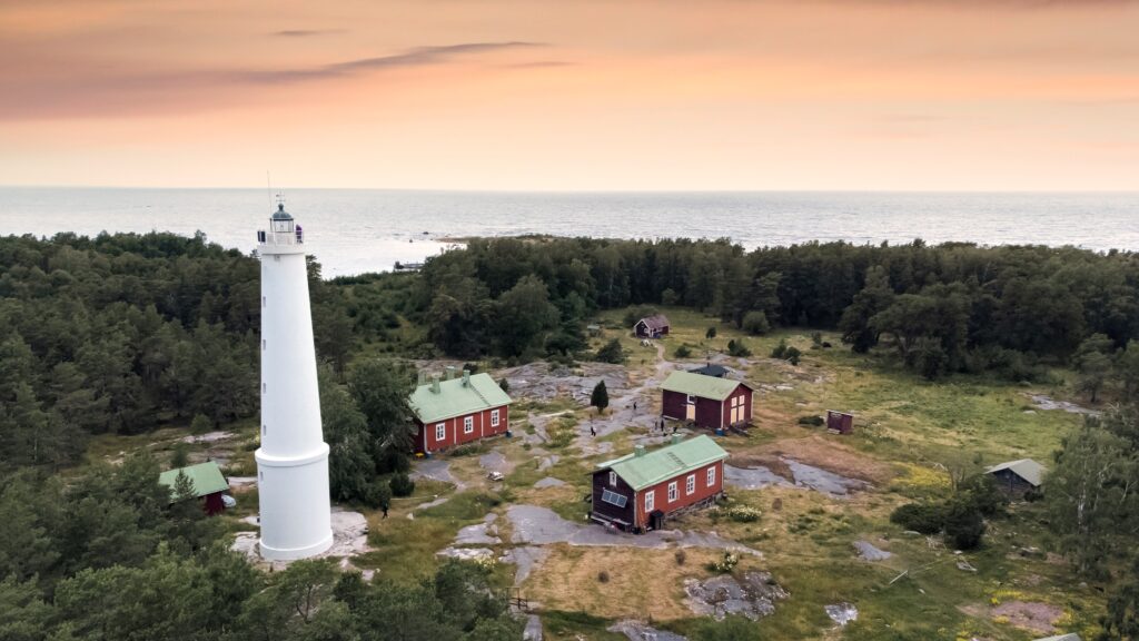
Säppi is one of the Bothnian Sea National Park's concrete hiking destinations. The island is located off Eurajoki and can be reached by boat. On the island is the approximately 1.3-kilometre-long Alfredin polku , a nature and cultural trail connected to the lighthouse, the history of the lighthouse keepers and the open coastal landscape.
The trail is short and relatively easy. The challenge lies in the logistics, weather, and limited service. There is no reason to count on drinking water being available on the island. Bring all the water you need, even if you are planning a short trip.
Check boat transport, landing conditions and weather forecast on the same day. A boat trip that works in calm weather is not automatically suitable when the wind picks up. Only camp in places where camping is allowed. Fires may only be lit in designated areas and never when a fire ban is in effect. Dogs must be kept on a leash.
Luontoon.fi describes the Bothnian Sea National Park as a marine area where more than 90 percent is water. An offline map and extra margin are therefore wise. On an island, it is more difficult to change your plan once you have set foot on land.
4. Yyteri – sand dunes, beach and coastal forest
Yyteri is more than just a long sandy beach. There are dunes, pine forests, wetlands and open views of the Bothnian Sea. The beach is a nature experience in itself, but it should not be confused with the marked trails.
For a concrete tour, Santojen lenkki is a clear option. The official information states it is approximately 5.4 kilometers long and describes a route over dunes, through coastal forest and along the beach. At Munakari there is a view of the island and a campfire site.
Sand is more taxing on your legs than a hard path. Adjust your pace, especially if you are walking in loose sand or up and down dunes. The coastal breeze cools even on a hot day, and weather changes quickly on the open beach. Bring water, a packed lunch, sunscreen and an extra layer.
Also note that dogs are not allowed on the official bathing beach along the part of Santojen lenkki that touches the beach. Check the signage on site. Yyteri dunes are sensitive; stay on the trail and avoid disturbing vegetation.
5. Lietteiden reitti – birds and birdlife at Preiviikinlahti
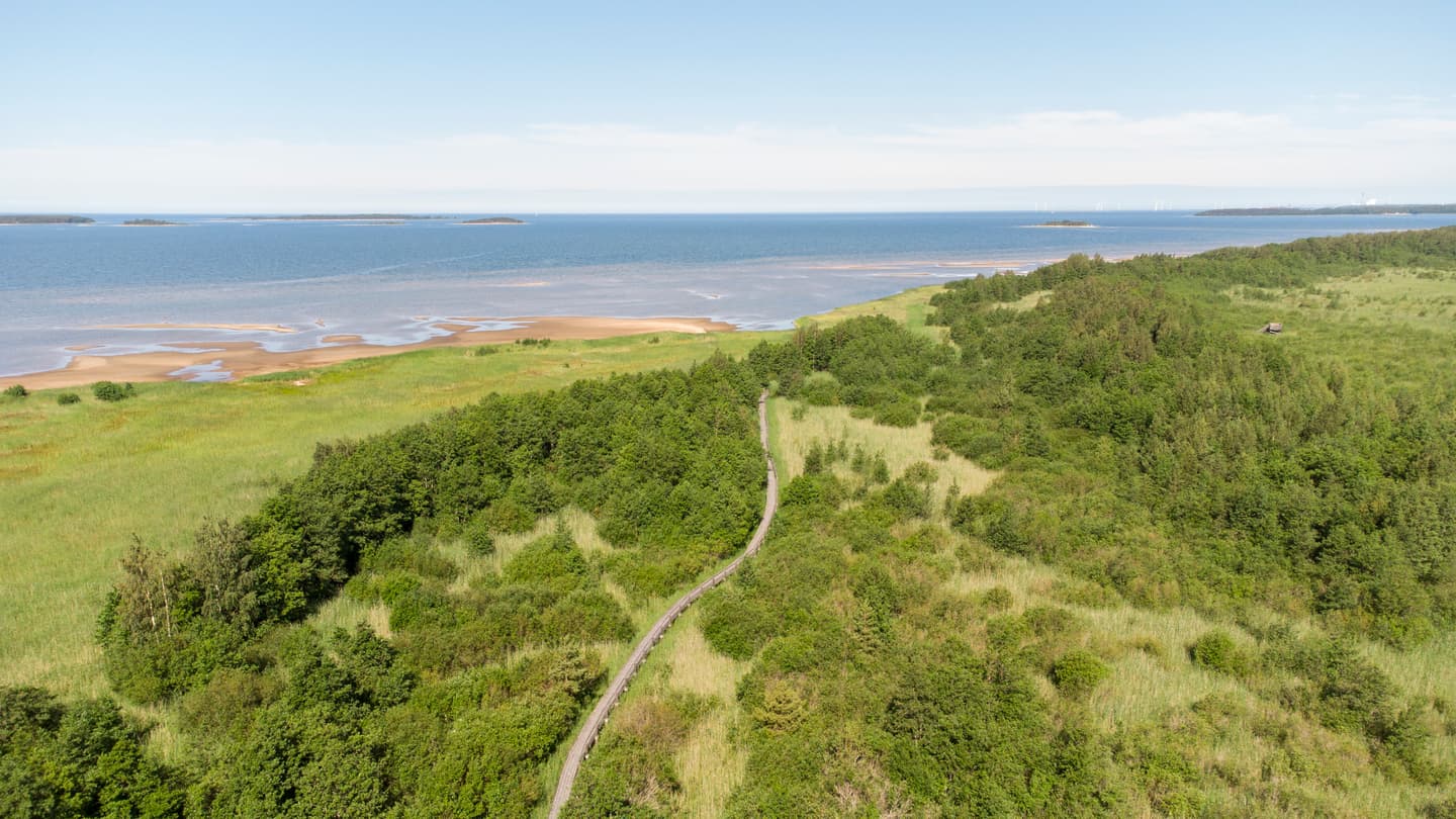
The Lietteiden reitti runs between the Yyteri dune area and the bird beaches at Preiviikinlahti. Luontoon.fi lists the trail as approximately four kilometers , a two to four hour hike, while Pori's newer map material lists approximately 4.7 kilometers in one direction. The difference is likely due to measurement and starting point. Therefore, do not plan based on an exact total number, but check the current map.
This is an easy, flat trail with forest paths, wetlands, bridges and several birdwatching towers and viewing platforms. It is suitable for beginners, but the bridges can be slippery. During the spring snowmelt, the official information recommends boots.
The trail is located in an important bird area. During migration in spring and autumn, bird life is particularly rich. Please be considerate by staying on the trail, keeping your noise level low, and following any temporary bird protection instructions. Bring binoculars if you want, but don't forget a packed lunch and water.
6. Enäjärven kierros – a short lake tour with bird tower
Enäjärven kierros is a circular trail in Meri-Pori, approximately 4.2 kilometers long. It follows the shores of Enäjärvi through forests, wetlands and footbridges. There is a birdwatching tower along the way, making the trail interesting for those who want to combine hiking with birdwatching.
This is a suitable destination for a half-day hike and for beginners who want to try a marked nature trail. The surface is not completely smooth, however. Roots, bridges and shorter sections of road or gravel mean that regular walking shoes are not always the best choice. Choose shoes with grip and check the condition of the bridges after rain.
Use Luontoon.fi's current route information for the Enäjärven kierros trail for a map and details. Bird towers and wetlands are sensitive environments. Keep your dog on a leash and do not leave the trail to get closer to the birds.
7. Torajärven reitti – forest and lake in Noormarkku
Torajärven reitti is a trail in Noormarkku and Finpyy, approximately 13.5 kilometers long, which is part of the Porin Karhureitti. It runs through forest and lake landscapes and passes, among other places, Torajärvi with a rest stop at a laavu.
This is a different type of hike than Yyteri. The terrain is more of a forest path and the route requires more planning, especially since it is a trail and not a simple circular route. Choose a partial route if you want to do a day trip without the logistics of two vehicles.
Download a map or GPX fromPorin Karhureitti's information at Luontoon.fi and check connections, rest areas and current trail status. Mobile phone coverage may be limited in the forests. Therefore, bring an offline map, a charged phone and a compass.
Equipment for Satakunta's varied trails
For day trips, a small backpack , water, lunch, first aid, extra layers and rain gear are often enough. On sand and gravel, poles are useful if you are already used to them. Hiking poles can relieve the strain when the sand tires your legs or when the ground is slippery.
For a night out, you need to think in layers: first protection from wind and rain, then a sleeping system that works at the actual temperature and on the actual ground. A sleeping pad that is too thin can cause ground chill even on a mild night. When choosing a sleeping bag or quilt , consider temperature, wind and how easily you get cold. Please read HikingStore's guide to down, CUIN and fill weight before comparing insulation.
A tent must withstand the environment it will be in. On the coast, wind is more important than a few grams saved. In the forest, ventilation and protection against condensation are often more important than maximum tightness.

Before you leave
Plan according to season, group experience and transportation. Bring more water than you think you will need on coastal stretches and islands. Check for ticks after each trip and use long pants or tick repellent in forests and tall grass. Mosquitoes can be a problem in wetlands during the summer.
The right of public access does not apply without restrictions in national parks and nature reserves. Follow local rules for dogs, fires, camping and bird protection. Bring a garbage bag. In the Bothnian Sea National Park there is no reason to count on recycling facilities on the islands.
The best equipment isn't the lightest in every situation. It's the one that works when the wind picks up, the footbridge gets slippery, and the temperature drops after sunset.