
 Svenska
 Dansk
Dansk
 Suomi
Suomi
 Deutsch
 Polskie
 Français
 Nederlands
 Italiano
 Español
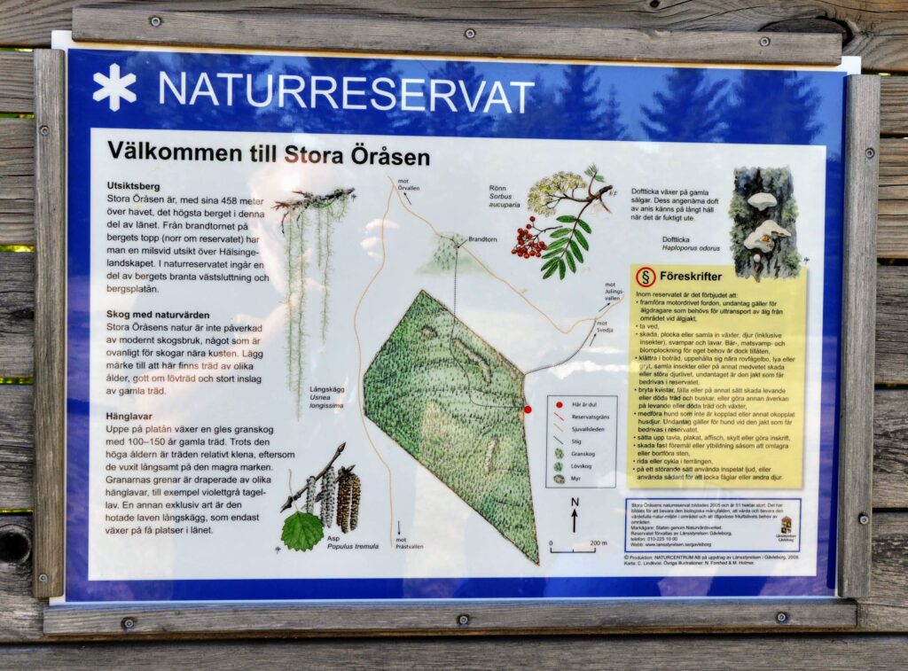
Hälsingland is a landscape of forests, lakes and hills. On several of the highest mountains, towers still stand that were built for a completely different purpose than today's excursions. They were to detect forest fires before they could spread.
Today, many of them are used as observation towers. Some are renovated and open to climbing. Others are worn out, closed, or only documented in older sources. That's an important distinction. A tower that looks climbable is not automatically safe.
There are records of around 16 or more fire and watchtowers in Hälsingland with varying status. The exact number depends on how you count. Some towers are historical fire towers, others are later lookout towers or watchtowers that have been given the same name in popular parlance.
Here is a guide to some of the most interesting places, from more accessible excursion destinations to towers where route choice, condition and local information play a greater role.
That's why fire towers were built
Most fire towers in this part of Sweden were built in the 1930s and 1940s. Forestry was extensive and the ability to quickly detect smoke was crucial. From a high tower, a fire watchman could look over large areas and raise the alarm before the fire became difficult to control.
During World War II, some towers also served as aerial observation posts. The high location provided good views of the landscape and made the towers useful for air surveillance.
When firefighting developed in the 1960s, the need for many permanent fire stations disappeared. The towers were dismantled, demolished or left to the elements. Some were saved through local initiatives and have been given a new lease of life as tourist attractions.
It's that history that makes an excursion more than a walk to a view. The question also becomes: What was the search for from here, and what was the work like before today's technology took over?
Stora Öråsen – a renovated tower with a long view
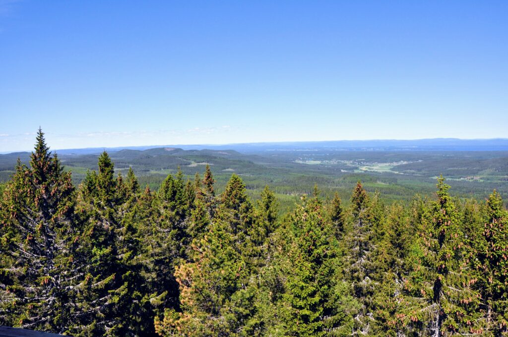
Stora Öråsen in Hudiksvall municipality is one of the most accessible excursion destinations in this guide. The approximately 17-meter-high fire tower was built in 1939 and has been renovated. From the top you get a sweeping view of the forest landscape and large parts of Hälsingland when the weather is clear.
According to descriptions of the area, it is possible to get close to the reserve by forest road. After that, there is about a kilometer of trail to the top. The entire round trip can be about two kilometers, which makes the place suitable even for a shorter family outing.
The hike goes through high altitude spruce forest and passes through marshland. During wet periods, waterproof shoes are a definite advantage. The path can also be difficult to assess after rain or thawing.
The renovated tower is climbable, but the height should be taken seriously. The stairs are narrow and at the top, wind and dizziness can affect your balance. Hold on to the railing and let anyone who is afraid of heights stay on the ground.
Read more about the area at Natur i Gävleborg and also check current information at the County Administrative Board in Gävleborg .
Granås and Luråstornet – older fire towers with 360-degree views
Luråstornet is located at Granås or Luråsen in Hudiksvall municipality, in the area around Hassela. The location is usually highlighted for its open views in all directions, and the tower itself is described as an old fire tower in good condition.
There are two common ways to get here. The longer route is via the Älvåsleden trail from Hassela Ski. The shorter option starts from the northern end of Älvsjön and follows a more hilly path. The difference is practical. The longer route is suitable for those who want to make the hike itself a larger part of the day, while the shorter route is more reasonable if the main goal is the tower and the view.
Regardless of the route, it is wise to expect uneven ground, damp sections and some elevation gain. You don't need over-gear, but you do need shoes that work on wet trails and clothing that can handle the rapid changes in weather. The view at the top is the point, but the way there often determines how good the day actually is.
More local information is available at Upplev Nordanstig . Check directions and current status before setting off. Forest roads and trails are subject to change, and older descriptions are not always sufficient as a basis for navigation.
Belsåstornet – renovated air surveillance tower south of Bollnäs
Belsåstornet is located south of Bollnäs and is a former air surveillance tower, approximately 20 meters high, which is now used as an excursion destination. The tower has been renovated and is open to climbing at your own risk. At the top there is both a cabin and a platform with a railing, which makes the place unusual compared to several other towers in the landscape.
There is also a rest cabin, wind shelter and barbecue area at the base. This makes Belsåstornet more useful for a half-day trip or family outing where the break itself is part of the experience, not just the view from the top.
The tour is accessed via Belsbo, but the last kilometer or so is on foot and ends with a steep climb. It is a short distance on the map, but not necessarily an easy finish. Here it is clear that short tower excursions still require good grip under the shoes and a sufficiently calm pace on the uphill.
Hårgaberget – observation tower with connection to Hårgalåten

Hårgaberget is located approximately 3.5 kilometers north-northeast of Kilafors in Bollnäs municipality. The mountain is approximately 212 meters high and is a well-known excursion destination with both views, a top cabin and cultural history.
Here stands a timbered observation tower that was inaugurated in 1985. It is not an original 1930s tower in the same way as Stora Öråsen and Luråstornet. The tower is still sometimes counted among Hälsingland's fire towers because it serves the same function as a lookout point over the forest landscape.
The tower is about 15 meters high to the top of the roof and the upper platform is about 12 meters above the ground. The railings and stairs have been overhauled in modern times, but even a well-maintained tower requires care.
The place is also associated with the legend of Hårgadansen and the well-known Hårgalåten. This gives the excursion a cultural dimension that distinguishes Hårgaberget from many other viewpoints.
Read more about the mountain and the tower at Visit Hälsingland and Wikipedia , which also reports on the tower's history and dimensions.
Höleklack – steeper path and rest hut near the top
Höleklack is located in Rengsjö in Bollnäs municipality and reaches 352 meters above sea level. It is the highest mountain in the Rengsjö area and at the top there is a tower with views of the landscape in several directions.
There are two common routes up. From Västra Höle the road goes towards Lake Ijungen, where a sign points towards Höleklack. Then follows a marked path with a steep climb. From Nordanhöle an uneven road leads to a path that leads about a kilometer up to the summit.
Here, poles or hiking poles are a practical aid, especially if the ground is wet or loose. HikingStore's hiking poles can provide better support both uphill and downhill, but they are no substitute for good shoes and a leisurely pace.
A small rest hut near the top makes it easier to plan a break. Bring your own water and something to eat. The steep part is often felt more on the way down, when your legs are tired and your concentration starts to wane.
See current information at Bollnäs Municipality .
Tjuvberget – nature reserve with a view of Hertarna
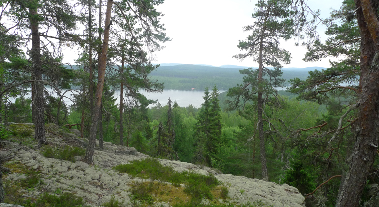
Tjuvberget is located about five kilometers south of Bollnäs, by Lake Övra Herten. The nature reserve covers 91 hectares and has a varied environment with cliffs, rocky areas, old pine and spruce forests.
The path from the parking lot to the top is relatively demanding. At the top there is a lookout tower or watchtower that is often mentioned among the fire towers of Bollnäs municipality. The view over the lakes Hertarna and the surrounding forest landscape is the main reason to go here.
Tjuvberget is also a nature reserve. This means special rules. You are not allowed to damage trees, pick plants or make fires except in designated areas. During parts of the year there may also be restrictions on where you can go. Follow the signs and stick to the path.
The County Administrative Board's page about Tjuvberget contains coordinates, information about parking and the reserve's regulations.
Björnberg Tower – one of the tallest preserved towers in Gävleborg
Björnbergstornet is located in Ljusdal municipality and is one of the more historically interesting towers in the landscape. The information about the height varies somewhat, but the tower is usually stated to be around 24–27 meters. This makes it one of the tallest preserved fire towers in Gävleborg.
The current tower was built in 1932–1933 after an earlier tower from 1893 was destroyed in a storm. That background says something important about these structures. They were built for function, but they were also exposed in high locations where weather, wind and time took their toll.
For the visitor, this means that Björnbergstornet is interesting both as a viewpoint and as part of the forest's history. But the same basic rule applies here as at other lesser-known towers: don't just judge the place by older descriptions. Check accessibility, road standards and condition before you go.
Tjännåsen fire tower – from forest guard to military silhouette
Tjännåsen fire tower is located southwest of Hudiksvall. It was built in 1940 by the Swedish Forestry Agency and was originally an eight-meter-high wooden tower. The current tower has a different character and is described more as an air defense observation tower than a classic open fire tower.
That is why Tjännåsen is a good example of how the term fire tower in Hälsingland does not always refer to the same type of building. Some towers are clearly 1930s constructions for forest fires, others have changed over time and taken on the characteristics of air surveillance or defense facilities.
For those who want to understand the history of the landscape's towers, Tjännåsen is therefore interesting, even if the experience is different from the more traditional observation towers. It is not only the height that matters, but also what the tower was actually built for and how it was later used.
Häståsen – an older tower where current status is important
Häståsen is located southwest of Ulvsta in the Ockelbot area, at an altitude of approximately 290 meters. Local descriptions indicate an approximately 20 meter high watchtower with panoramic views in several directions.
This is a place where you should be extra careful. The information about the tower is older and there is limited current tourist information about condition, access and possible closures. Do not climb if the structure feels unsafe, if parts are missing or if there are signs prohibiting access.
Information about Häståsen can be found in the local description of Ulvsta, among other places. Please check with the local landowner, association or municipality before planning a visit.
Equipment for a safe fire tower excursion
Most tours don't require advanced equipment, but you do need to think about what each item will actually handle.

- Shoes: Choose shoes with good grip and support. For wet trails, waterproof boots are often more useful than lightweight casual shoes.
- Clothing: A rain jacket and an extra layer of reinforcement weigh little but make a big difference when the wind picks up at the top. See HikingStore's range for complementary outdoor equipment.
- Backpack: A small daypack is enough for water, lunch, extra clothing, first aid and a phone.
- Hiking poles: Practical on steep trails like Höleklack and Tjuvberget.
- Navigation: Have a map or a downloaded map service. Your cell phone's battery can run out, especially in cold weather.
- Safety: Leave information about your route and don't assume that your cell phone has coverage.
A trip to a fire tower should be simple, but not careless. Check the weather forecast, respect roadblocks, and turn around when conditions require it. The best tower visit is not the one where you push yourself the hardest, but the one where the equipment works, the view can be enjoyed in peace, and you return safely.
Plan according to the condition of the tower – not according to the symbol on the map
Historic fire towers are valuable because they tell the story of an older way of working with forest fires and emergency preparedness. They are also structures that are exposed to snow, wind, moisture and temperature changes year after year.
Therefore, always check:
- if the tower is open,
- if stairs and railings are intact,
- if the path is passable,
- whether the area has special reserve rules,
- if the road to the parking lot is passable.
Stora Öråsen, Luråstornet and Belsåstornet are good examples of towers that combine history with a clear excursion experience. Hårgaberget shows how a later observation tower can live on in the same tradition. Höleklack and Tjuvberget combine the tower experience with steeper hiking and natural values. Björnbergstornet and Tjännåsen broaden the picture with a more pronounced forest and guarding history, while Häståsen reminds us that older information is not the same thing as a guarantee of safe access.
It is precisely the variety that makes Hälsingland's towers interesting. Choose a location according to the season, the group's experience and the weather conditions. Then the fire tower will not just be a goal at a height, but a safe path to both history and views.