
 Svenska
 Dansk
Dansk
 Suomi
Suomi
 Deutsch
 Polskie
 Français
 Nederlands
 Italiano
 Español
 Norsk
Norsk

This is the sixth article in HikingStore's Denmark series about hiking. After Bornholm, Zealand, Funen, Lolland-Falster and Møn and South Jutland, it's time for Central Jutland.
Central Jutland is primarily a geographical designation. The area includes the interior of central Jutland with Søhøjlandet, Silkeborgsøerne and Gudenådalen as well as cities such as Silkeborg, Skanderborg, Horsens, Viborg, Randers, Herning and Holstebro. It should be distinguished from Eastern Jutland with Aarhus, Djursland and Mols Bjerge, Western Jutland with the North Sea coast and Skjern Å and Northern Jutland with Himmerland and Rebild.
The landscape is not high in the Swedish sense. But the differences in altitude in Søhøjlandet are the largest in Denmark south of the Limfjord. Short hills, roots, stairs and muddy paths can therefore put more strain on the legs than the map suggests.
1. Himmelbjerget and Slåensø – views, beech forest and steep paths
Himmelbjerget reaches approximately 147 meters above sea level. Himmelbjergt Tower is approximately 25 meters high and offers views of Julsø and the surrounding lake landscape.
From the jetty at Julsø, the winding Slangestien trail leads about 1.2 kilometers up to the summit. There are also several marked routes between Himmelbjerget and Slåensø, including yellow loops of about 2.3–7.2 kilometers. A loop around Slåensø is about three kilometers.
The terrain is forest path, roots, gravel and steeper sections. The difficulty level is moderate and the trail is not suitable for wheelchairs or people with reduced walking ability. Spring, summer and early autumn work well, but rain makes the roots slippery and the paths muddy.
The area can be reached by car, bus or seasonal scheduled boats from Silkeborg and Ry. It is possible to combine the hike with a boat on Julsø, but timetables should be checked separately. Also check the current map, water level, dog rules and the rules at Slåensø. Canoeing, kayaking, SUP and inflatable toys are not allowed in Slåensø. Cycling is not allowed on the yellow hiking trail along the north side of the lake. See the Nature Agency's information about Himmelbjerget and Slåensø .
2. Himmelbjergruten – Gudenåstien north of the lakes
The northern section of the Himmelbjerg Route is called Gudenåstien and runs between Ry and Silkeborg on the north side of the Himmelbjergsøerne. The section is approximately 25 kilometers long and is marked.
Here you get forest, lake views, more open areas and several clear elevation differences. The surface varies between forest road, gravel and path. The difficulty level is moderate. The Udinaturen indicates steep sections, and a long day on the trail requires both water and a packed lunch.
Ry and Silkeborg serve as practical starting and ending points. In some cases, the stage can be divided by train, boat or ferry, but boat connections on the lakes are seasonal. Check the wind and weather conditions before starting. Sea weather affects the temperature quickly, even when the hike starts in the lee.
See the route information on Udinaturen.dk and download the current map or GPX file before you go.
3. Yding Skovhøj – Denmark's second highest point
Yding Skovhøj is located in Horsens municipality and is an archaeological site with shorter marked trails. If the Bronze Age burial mound on top is included, the height is stated to be 172.54 meters above sea level. The natural ground surface is about 170.8 meters.
It is a Danish border case that is often simplified in tourist information. Møllehøj is Denmark's highest natural point, while Yding Skovhøj is higher if the burial mound is included. Internationally, the heights are modest, but the entire Søhøjlandet is hilly and the slopes become noticeable after several hours.
The trails consist of grass, dirt and forest roads. The hike is easy to moderate but can get muddy after rain. Spring and autumn bring vivid colors and less heat; summer is easier if the ground is dry. Bring an offline map as the shorter trails don't always feel as obvious on site. Check markings, parking and any roadblocks on Udinaturen.dk .
4. Møllehøj and Ejer Bavnehøj – highlights with historical discussion
Møllehøj is located in Skanderborg municipality near Ejer Bavnehøj and is Denmark's highest natural point, about 170.9 meters above sea level. Ejer Bavnehøj has a lookout tower and shorter hiking trails in the area.
The nature is open hills, agricultural landscapes and small patches of forest. The surface is mainly grass and gravel, but rain can make the slopes slippery. The difficulty level is easy to moderate. It is a good destination for a shorter trip or as part of a day where the highlights are combined.
Transportation usually requires a car or careful planning with local public transportation. Check current access to lookout towers, trail markings, and whether any trails pass near private land. Stick to roads and marked trails. This is especially important here as the landscape alternates between public, state, and private land.
5. Silkeborgsøerne – beech forest and lake landscape
The Silkeborgsøerne are the core of Søhøjlandet. A concrete shorter option is a marked loop around Almindsø. For a longer hike, you can follow a marked part of the Aarhus–Silkeborg hiking route, which is approximately 64 kilometers in total and passes both Slåensø and Himmelbjerget.
Beech forests, lake shores, gravel roads and hilly forest paths dominate. The difficulty varies from easy on shorter rounds to moderate on longer stages. Light shoes with good grip are often a better choice than heavy boots. The important thing is stability, ventilation and grip on roots and wet soil.
Silkeborg is the natural base for public transport and supplies. Bring water and a packed lunch even on shorter trips. The forests can feel denser than they are, so download an offline map. Also check if you pass by swimming areas, private paths or areas with special dog and bicycle regulations.
6. Hald Sø and Dollerup Bakker – ice age landscape near Viborg

At Hald Sø you will encounter hilly beech forests, heathland, historical remains and views over a long, deep lake. The Nature Agency describes several marked tours. A classic option is the approximately six-kilometer long path around Inderøen. Dollerup Bakker offers steeper sections and views over the lake.
The surface alternates between forest path, grass, gravel and roots. The nature trail through Dollerup Bakker is very hilly and not suitable for people with walking difficulties. Spring and autumn are good for views and colors, but the ground can get muddy. Summer can mean mosquitoes, ticks and drought.
The area contains both state and private land. Follow the signs carefully. Also check water levels, hunting or nature conservation information, dog regulations and trail status before setting off. Read the Nature Agency's information about Hald Sø .
7. Bølling Sø – lake, marshland and birdlife
Bølling Sø at Engesvang is a good option if you want to combine lake scenery with wetlands. The marked trail around the lake goes through restored nature with birdlife, open beaches and spans wetter areas.
The hike is easy to moderate. The terrain is gravel, grass and footbridges, but rain can make parts slippery or soft. Spring and autumn are especially interesting for birds, while summer brings more insects and a higher risk of dried-up water sources. Bring your own packed lunch and enough water.
Bølling Sø is easiest to reach by car or through local travel planning. Check the current trail status, bird protection and whether any part of the footbridge is closed. Do not go out onto sensitive coastal meadows to get closer to the birds. Use Udinaturen.dk for current route and facility information.
Danish right of access – right of public access does not apply
Denmark does not have Swedish or Finnish public access rights. Access depends on whether the land is state-owned, public or private and on the type of nature you are in.
In private forests, walking and cycling are normally limited to roads and paths, usually between 6 am and sunset. You should not stay within 150 meters of homes or farm buildings. Many areas around Silkeborg and Hald Sø are state-owned or managed by foundations, but private land also exists. Always follow the signs.
Nature reserves may have additional rules about dogs, cycling, campfires and access. Dogs should normally be on a leash. Dog forests and certain winter rules on beaches are exceptions. At Slåensø, special rules also apply to both water activities and cycling.
Read the current rules at the Danish Nature Agency and check maps and facilities at Udinaturen.dk .
Free camping and the 1–2–3 rule
Free camping is an exception that only applies in selected state forests. The rule is:
- maximum one night in the same place,
- maximum two tents,
- Maximum of three people per tent.
The tent must be hidden in wooded land and must not be visible from a road, path or building. You may not camp on a beach, dune, meadow, bog, heath, field or open clearing.
Open fires may only be used in designated fire pits. A closed emergency kitchen may be permitted, but fire bans and local regulations must be checked on the same day. There are primitive overnight accommodations and shelters in the area around Slåensø and Silkeborgsøerne. They may require reservations or be first come, first served. Therefore, do not plan a multi-day trip based on the certainty that a shelter will be available.
See the Swedish Nature Agency's rules for free camping .
Equipment for hilly forest terrain
Central Jutland does not require mountain equipment, but the terrain requires functional basic equipment. On a day trip you need water, a packed lunch, rain gear, an offline map, first aid and shoes with good grip. Ticks and mosquitoes are common in grass, forests and wetlands. Check your body after the hike.
For overnight stays, a sturdy tent, a backpack with a functional hip belt, and an insulating sleeping pad are more important than hunting for every gram. See HikingStore's tents , backpacks , and sleeping pads .
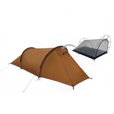
Hilly terrain with many meters of elevation is more tiring on the legs than the low altitude suggests. A sleeping pad that is too thin can also cause the ground to be cold and impair recovery after a long day. For sleeping bags or quilts, see HikingStore's sleeping systems and our guide to bird down , where CUIN, down types and fill weight are explained.

Also read our packing list for mountain hiking in the summer and adapt it to weather, distance and type of accommodation.
Central Jutland rewards those who plan according to the terrain. Check weather, wind, trail status, access rules, fire and overnight stay before you go. The next part in the Denmark series will be North Jutland , the last part before the series about Denmark is complete.