
 Svenska
 Dansk
Dansk
 Suomi
Suomi
 Deutsch
 Polskie
 Français
 Nederlands
 Italiano
 Español
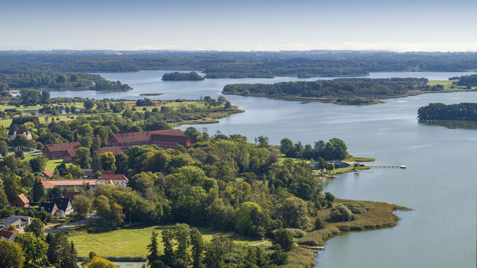
Lolland, Falster and Møn are located south of Zealand and offer a flatter but varied hiking landscape. Lolland and Falster are located west of Møn and are connected to each other. Møn is reached from Zealand via the Dronning Alexandrines Bro at Kalvehave.
Here you will find limestone cliffs, coastal forests, fjords, coastal meadows and bird-rich wetlands. The elevation differences are usually moderate, but wind, sand, mud, stairs and water levels can make the tours physically demanding.
The highest point on Møn is Aborrebjerg, 143 meters above sea level. This is not the same as Møns Klint's highest vertical cliff face, which the Nature Agency states is about 128 meters down towards the shore. The highest point on Lolland-Falster is Bavnehøj near Nr. Vedby on Falster, about 39.5 meters above sea level – or about 44 meters if the burial mound is included.
This is the fourth article in HikingStore's Denmark series, after Bornholm , Zealand andFunen . Møns Klint, Klinteskoven and Camønoen were already covered in the Zealand article. Therefore, we focus here on concrete routes and areas that provide new perspectives.
1. The Jydelejet route on Møn – limestone overburden and Aborrebjerg
The Jydelejet route is a marked round trip of approximately 3.3 kilometers. It goes through calcareous grasslands, forests and open overgrown meadows with the opportunity to see orchids and other calcareous plants. The route passes Jydeleje Fald and goes up over Aborrebjerg.
The surface consists of grass, forest path and shorter steeper sections. The tour is relatively short but not completely flat. After rain, the grass and soil can become slippery.
Aborrebjerg is the highest point on Møn, 143 meters above sea level. This does not say anything about the vertical height of the cliff wall on the coast, which is why the numbers are sometimes mixed up.
Plan as follows: use the Swedish Nature Agency's route description , bring water and wear shoes with good grip. Check current signage and any roadblocks before setting off.
2. Klintekongens Rige – a full-day tour in steep rocky terrain
The Klintekongens Rige runs in the same area as Møns Klint and Klinteskoven, which were already described as main destinations in the article about Zealand. The route is still worth mentioning here because it provides a more demanding and continuous hike.
The official length is approximately 14.5 kilometers, although other maps may show slightly longer depending on the terrain. The route opened in 2022 and has been named one of Europe's best hiking trails by the Deutsches Wanderinstitut. Common route descriptions state around 477 meters of elevation gain and up to 1,000 steps, but the Nature Agency's material emphasizes the length and that the trail requires good fitness.
The terrain is steep, rocky and varied. You will walk on forest paths, roots, stairs and coastal sections. Some stairs may be closed after landslides, storms or maintenance. The cliff edge can collapse and sections of the beach can change quickly.
This is a full-day tour, not a longer coffee break. Start early, bring a packed lunch and water and use an offline map. Follow only marked trails. Do not walk under overhangs and respect all barriers. Check current information with the Norwegian Nature Agency , Udinaturen and GeoCenter Møns Klint before the tour.
3. Ulvshale on Møn and Halskov Vænge on Falster
Ulvshale on northern Møn combines coastal forest, coastal meadows and low coastal landscapes. The area has good opportunities for birdwatching, but birdlife requires distance and consideration.
During the period 15 March–15 July, you should stick to roads and paths in the meadows. Special restrictions apply to Nyord meadows and some parts are completely closed. Always check the current signage.
Halskov Vænge, on the other hand, is located on the east coast of Falster, not on Møn. The marked Nature Agency route is approximately 2.4 kilometers and goes through forest, past burial mounds and further towards Halskov Enge. The surface is mainly paths and forest roads with some more open sections.
These are easier tours that are suitable for spring, summer and early autumn. Wind and rain can still make open coastal meadows cold. Ticks and mosquitoes are found in tall grass and damp areas.
Check the Norwegian Natural Resources Board's information about Halskov Vænge and current information about Ulvshale–Nyord before you go.
4. Maribosøerne Nature Park – lakes, forest and white-tailed eagles
Maribosøerne Nature Park on Lolland is an entire natural area, not a single continuous trail. Around Hejrede Sø and Søndersø, among other places, there are marked routes, forest paths and opportunities to combine shorter rounds.
The landscape consists of lakes, forests, wetlands and open fields. The birdlife is rich and the area is known for, among other things, white-tailed eagles. The ground is usually lighter than on Møn, but gravel, grass and clay occur.
Spring and autumn often provide good conditions for birdwatching. Summer also works, but bring mosquito repellent and enough water. Bird sanctuaries and areas near water may limit access. Follow marked trails and do not enter restricted areas.
Use Naturlandet Lolland-Falster to find current routes and facilities. The app also shows shelters and other places to stay, but booking is often done via a separate booking service.
5. Nakskov Fjord and Albuen - walk towards the lighthouse
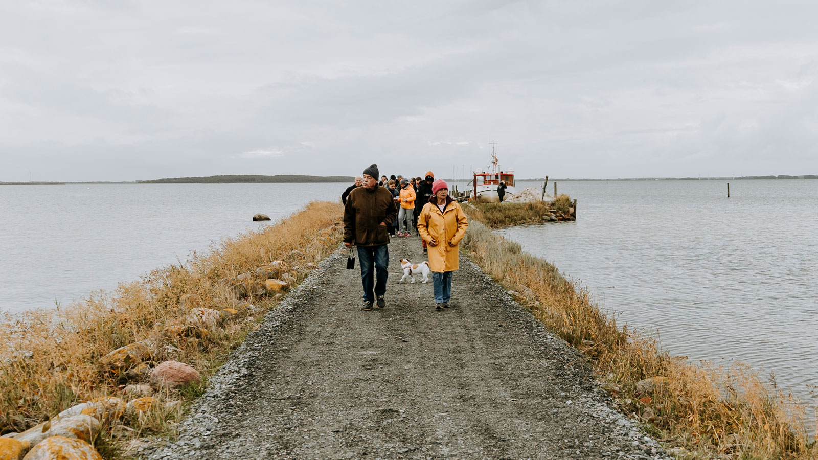
Nakskov Fjord on western Lolland is a protected fjord landscape with islands, birdlife and coastal history. At Albuen you walk along the dike towards the lighthouse and the outermost part of the sandbar.
The distance to the lighthouse is often given as about 6 kilometers one way. The official route Ud on Albuen is given in different ways: Udinaturen shows an approximately 5.7 kilometer long, unmarked route, while the tourist information describes the out-and-back trip as about 11.5 kilometers.
The surface is flat but can consist of gravel, grass, sand and narrow paths. At Skæret, high tide, storm or strong wind can close the road. Do not turn around when the water is already over the path. Check the weather, water level and current information before starting.
Bring your own packed lunch and water. Don't expect any service along the tang. Read more at the Swedish Nature Agency and Udinaturen .
6. Bøtø Nor and Bøtøskoven on Falster
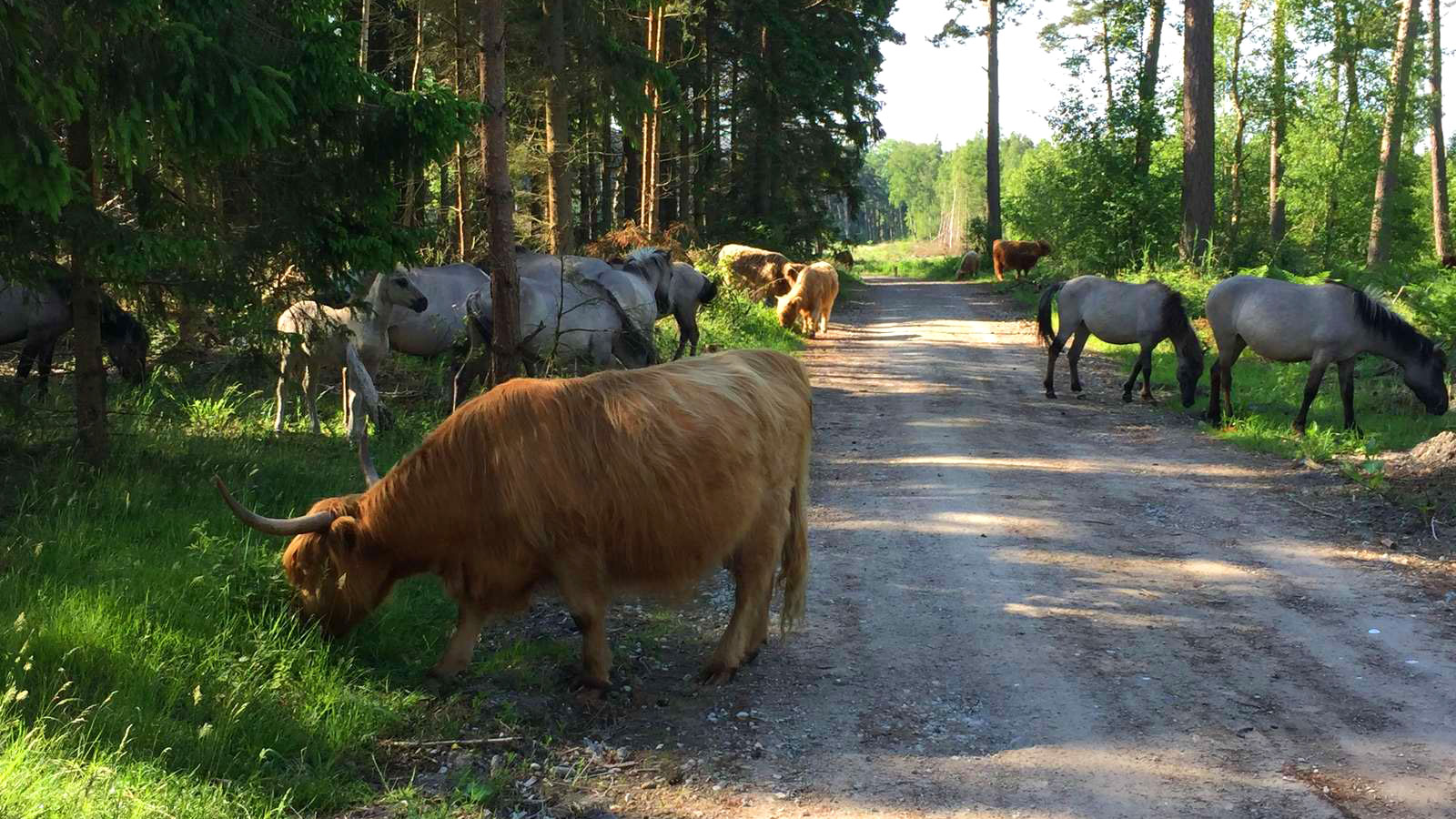
Bøtø Nor is a bird-rich wetland area on southern Falster. The Bøtø Nor trail is approximately 16 kilometers long and runs through open countryside, along ditches, canals, gravel roads and wetlands. The route partly runs over private land and may be closed temporarily, for example during hunting.
For a shorter tour, there is the approximately 5-kilometer loop in Bøtøskoven. There you will encounter coastal forest, damp depressions, pastures and sometimes wild horses or cattle. Parts of the area are a bird sanctuary.
The surface is light to moderate, but open dirt roads become muddy after rain. Keep your distance from grazing animals, close gates and keep your dog on a leash. Use SPOR.dk and Visit Lolland-Falster's route description for up-to-date information.
7. The exercise tube around Nykøbing Falster
The exercise hose is a longer local route of approximately 42 kilometers around Nykøbing Falster and through nearby forests, agricultural landscapes and areas at Guldborgsund.
The yellow marking shows the main route. Blue markings show detours at Bangsebro Skov, Sønder Kohave and Ravnstrup Skov, among others. The entire route is suitable for those who want to build a long day trip or divide the route into stages.
The surface varies between asphalt, gravel, forest road and path. It is not technically difficult, but the distance requires planning for water, food, energy and transport. Nykøbing Falster serves as a practical starting point, but check the current map and connections before deciding on the start and finish.
In comparison, Lolland-Falster's highest point, Bavnehøj, is near Nr. Vedby on Falster. The landscape is therefore low, but a long distance can still be noticeable in the legs.
Danish access rules – Denmark has no right of public access
Denmark does not have Swedish or Finnish public right of way. Access depends on landowner, habitat type and local signage. Always start with the rules of the Danish Nature Agency and Udinaturen.dk .
In state forests, access is often generous, but nature reserves, bird sanctuaries and temporary barriers apply. In private forests, walking and cycling are normally limited to roads and paths between 6 am and sunset. You should not stay within 150 meters of homes or farm buildings.
Beaches are often accessible on foot and for short stays. Camping on the beach and dunes is not permitted without express permission. Dogs should normally be kept on a leash. Some beaches have winter regulations that allow dogs to roam freely, but the dog must be under control and local signage always applies.
On Møn, several trails cross private land. The Klintholm Gods route and forest areas belonging to Klintholm Gods may have special rules. Therefore, follow the signs for the relevant trail rather than assuming that public access applies.
Free camping and the 1–2–3 rule
Free camping is an exception, not a general right. It only applies in selected state forests:
- one night in the same place
- maximum two tents
- maximum of three people per tent
The tent must be hidden in wooded land and not visible from a road, path or building. You may not camp on a beach, dune, meadow, bog, heath, field or open clearing.
Open fires may only be used in designated fire pits. A closed emergency kitchen may be permitted under current regulations, but always check fire bans and local regulations. Shelters and primitive overnight accommodations may require reservations, especially on Møn, Falster and Lolland during high season.
Equipment for coastal wind, sand and varying surfaces

For a day trip, you will need shoes with grip, rain and windproof clothing, water, a packed lunch, an offline map, first aid kit, a headlamp and chafing protection. Coastal winds can be colder than the temperature suggests. Sand and mud also make the trip slower than the map shows.
For overnight stays, you can see HikingStore's range of tents , backpacks , sleeping pads and sleeping bags . A wind-resistant tent and good tent pegs are more important on an open coastal site than in protected forest.
The sleeping pad must insulate sufficiently. A pad that is too thin will cause the ground to be cold and will make recovery worse. For a sleeping bag or quilt, read our guide to down, CUIN and fill weight . Also, feel free to use our packing list for summer hiking .
The best equipment is the one that works when the wind picks up, the trail gets muddy and the weather changes. The next part in HikingStore's Denmark series will be South Jutland .