
 Svenska
 Dansk
Dansk
 Suomi
Suomi
 Deutsch
 Polskie
 Français
 Nederlands
 Italiano
 Español
 Norsk
Norsk

The Alps are Europe's most developed hiking region. A large network of Alpenverein and other mountain huts, marked trails and good accessibility make it possible to plan everything from a week-long cabin trip to a hike through several countries. But accessibility does not mean that the mountains are easy: high passes, rapid weather changes, remaining snow and glaciers require experience and margins. During the high season, it is often the location of the bed – not the trail itself – that limits planning.
Here we compare seven trails of varying length, terrain and difficulty. Distances are approximate and may vary with route choice, stage division and transport.
1. Tour du Mont Blanc: the classic with full cabins
The Tour du Mont Blanc (TMB) is a round trip of approximately 170 kilometres through France, Italy and Switzerland. Many people do it in around 10–11 days; depending on pace, rest days and route choice, 7–12 days is common. Les Houches and Chamonix are common starting points on the French side.
The stages go between valleys and mountain huts over high passes. Col de la Seigne leads into Italy, while Grand Col Ferret takes the tour back towards Switzerland. The terrain alternates between well-trodden paths, rocky high mountain terrain and steep valley passages. There are variations and on some sections it is possible to shorten the tour by bus or cable car, but check in advance how this will affect the day's plan.
The TMB is suitable for those with good basic fitness and are used to long days in the mountains. No hiking permits are required, but accommodation should be booked several months in advance. The trail is very popular and the cabins are often the most difficult piece of the puzzle.
2. Walker's Haute Route: longer days and more high alpine
Between Chamonix and Zermatt, the Walker's Haute Route stretches for about 215–225 kilometers. The standard plan is about 14 days; well-trained hikers can sometimes shorten the trip to 12. The trail crosses eleven high alpine passes and has about 14,000 meters of total elevation gain.
Expect a demanding ride over rocky passes, steep slopes and long valley stretches. Accommodation varies between mountain huts, gîtes and hotels, and booking is essential to make the stages work. The best season is usually from mid-July to mid-September, but check snow and trail conditions locally.
This is considerably tougher than the Tour du Mont Blanc and is not a suitable beginner's hike. Ask yourself not just if you can handle a long day, but if you can repeat it many days in a row.
3. Via Alpina: plan according to the new main route
The Via Alpina has historically consisted of five color-coded trails: Red, Green, Blue, Yellow and Purple. The older network included 342 stages. The red trail ran from Trieste to Monaco in 161 stages, while the green trail had 14 stages through Liechtenstein and Switzerland.
Important for those using older maps: From 2024 onwards, the Via Alpina will be presented as a single main route. It follows the former red route to stage R57 in Liechtenstein, continues via the former green route through Switzerland towards the Swiss Alpine Pass Route and then rejoins the red route towards Monaco. The current main route consists of 116 stages, totalling over 2,000 kilometres through all eight Alpine countries. Please check the new route information before planning according to older colour markings or stage numbers.
It is a long-distance project rather than a single holiday trail. Hikers can choose a continuous section and adjust the length and accommodation according to time, experience and conditions.
4. E5 Oberstdorf–Meran: a classic Alpine crossing
The classic hike on the E5 between Oberstdorf and Merano is around 140 kilometers and often takes 6–8 days. The actual distance can vary from around 106 to 174 kilometers depending on the route chosen, buses and cable cars. The stages often involve 800–1,200 meters of ascent per day, so good fitness is required.
You will hike through mountain passes, valleys and rocky terrain, staying overnight in mountain huts. The season is usually best from mid-July to late September, but opening times and conditions vary between huts. Book well in advance and do not plan a stage based on a transport connection until you have checked that it actually runs on the day you need it.
5. Alta Via 1: The Dolomites get their own guide
Alta Via 1 belongs in a comparison of the great alpine long-distance trails, but the Dolomites deserve their own review. We will therefore return to the trail in the next article in the series, with a particular focus on the Dolomites and South Tyrol.
6. GR®5 in the French Alps: long hike from the north to the Mediterranean
The GR®5 is a European long-distance trail, but the complete route from Hoek van Holland to Nice is around 2,600 kilometres. The Alpine section is often called the Grande Traversée des Alpes and runs from the area around Thonon-les-Bains on Lake Geneva to Nice. The length is often given as around 620 kilometres, but varies between around 560 and 620 kilometres depending on whether the starting point is Saint-Gingolph or Thonon-les-Bains and which variants are chosen. It is usually described as having around 36 stages and takes four to six weeks.
The trail passes through several mountainous areas and has long climbs and descents. For exact stages, trail status and any local restrictions, you should use current maps from FFRandonnée and information from the relevant local authorities.
7. Alpe-Adria Trail: from the Austrian mountains to the Adriatic Sea
The Alpe-Adria Trail connects Austria, Slovenia and Italy. The official route is around 750 kilometres and 43 stages, from the Grossglockner area to Muggia on the Adriatic Sea. The stages are on average around 20 kilometres and six hours of hiking, but the terrain and altitude differences mean that your daily fitness plays a big role.
The trail is signposted and passes through both mountainous and lower landscapes. It can usually be walked in both directions, and accommodation is available along the stages. Use the official stage planner for the current route and book accommodation based on your actual daily capacity.
Season, weather and when you should turn around
The general hiking season in the Alps runs from about mid-June to mid-September, with peak season in July and August. Snow may remain on high passes into June, and many huts begin to close from mid-September. Always check the conditions for your specific trail and dates.
Afternoon thunderstorms are a recurring risk. Start early, follow the forecast and leave exposed passes and ridges before the storm arrives. Fog can make even marked terrain difficult to navigate. The sun hits harder at altitude; wear sunglasses, covering clothing and sun protection. Snowfields can be slippery and hide unevenness. If you don't have the right equipment and the habit of using it, choose a safe detour or turn around.
Glacier passages are not ordinary hiking trail passages. They require alpine knowledge, the right equipment and often a guide. Do not cross a glacier or steep snowy terrain just because it looks like a shortcut.
Cabins, permits and regulations
No special hiking permits are normally required for these trails. However, huts must be booked, and popular accommodations may need to be reserved 3–9 months in advance. The Alpenverein's booking page is Hut Reservation/OHRS . Older references to alpsonline.org still exist, but the system was replaced for the 2024/25 winter season. Each hütte handles its own booking conditions, meals and rules. Half board is common at mountain huts, but check what is actually included.
Camping is more regulated than in the Nordic countries and is often prohibited outside of designated areas. Dog, tent and fire regulations vary between France, Italy, Switzerland, Austria, Germany, Slovenia, Liechtenstein and Monaco. National parks and protected areas may have their own regulations. Check the regulations for each country and area, and do not assume that one rule applies throughout the Alps. Border crossings on foot between France, Italy, Switzerland, Austria and Germany do not require special hiking permits; however, regular entry and visa regulations depend on your citizenship and travel plans.
Pack for the terrain – not for an ideal forecast
Choose shoes with good grip and bring poles if you usually use them on steep descents. Layers, rain and wind protection, a map and offline maps will help when the weather changes or mobile coverage disappears. Helmets and crampons only belong on routes where the conditions require them and you can use the equipment safely. Glacier terrain requires special equipment and expertise.
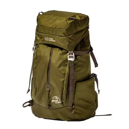
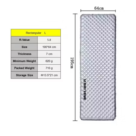
If you are staying in a cabin or gîte, you will not normally need to carry a tent, kitchen and food for the entire trip. Still, pack for an unplanned delay or change in weather. See HikingStore's range of backpacks , tents , sleeping pads and sleeping bags , and use our summer hiking packing list as a check before you set off.
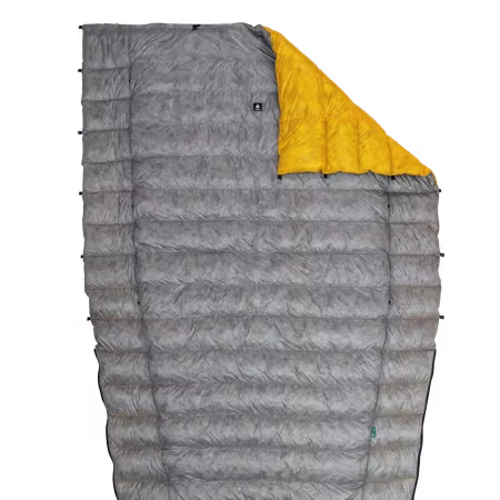
A lightweight quilt can be a practical choice when sleeping indoors and want to keep weight down, but choose insulation according to temperature and accommodation. Read more in our guide to down in sleeping bags . A low pack weight is good, but warmth and recovery are more important than saving every gram.
In case of an emergency, the common European emergency number is 112. Have insurance that explicitly covers mountain rescue and possible helicopter transport; the conditions differ between insurances and activities.
The best alpine long-distance trail is not the most famous or the longest. It's the one that suits your experience, your time, and the equipment you can rely on when the weather changes. The next article in the series is about the Dolomites and South Tyrol .
Sources
- Tour du Mont Blanc - official route information
- Walker's Haute Route – Cicerone Press
- Via Alpina – current main route and FAQ
- E5 – stages and planning
- GR®5 – FFRandonnée
- Grande Traversée des Alpes – Savoie Mont Blanc
- Alpe-Adria Trail – official website
- Alpenverein – booking mountain huts
- Alpenverein – safety information for mountain hiking